|


| |



Ferdinand Magellan was
the first European explorer to visit Chile, setting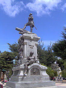 foot here on October 21,
1520.
In the late 15th
century, the Incas extended their empire south, attempting to conquer Chile;
they were successful in the north, but their influence (central and south) was
limited as they faced fierce resistance from the indigenous Araucanian peoples.
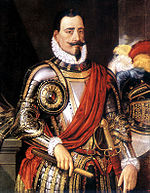
In 1540, the Spanish
explorer, Pedro de Valdivia arrived, and later founded the capital city of
Santiago in 1541. He managed to control the local Indians, forcing them into
hard labor, but in the south, the Araucanians would not budge.
Numerous Spanish
settlements were built in central Chile, and their population base eventually
exceeded one million. Those initial settlers suffered repeated attacks (often
brutal) by Araucanians, and that remained a serious (hard to control) problem
into the 19th century.
The colonies secretly
detested Spain's military rule, but remained loyal to the Spanish crown for
nearly three centuries. When the King of Spain was overthrown at the beginning
of the 19th century, Chileans began to consider independence and
self-government.
And speaking of freedom,
Jose de San Martin, and Bernardo O'Higgins, and their up-start armies drove out
the Spanish and achieved their independence from Spain in 1818. Bernardo
O'Higgins would later become Chile's first president.
Chile defeated Bolivia
and Peru in a regional war (1879-1883) for the control of the Atacama Desert
areas. During that war Chile gained more land to the north and Bolivia lost its
outlet to the open sea; proving disastrous (even today) for its economy.
Beginning in 1891, and
over the next 80 years, Chile was governed by self-serving parliamentary
regimes, military rule, left-wing, right-wing parties (including Communists) and
a long line of democratically elected presidents.
All remnants of
democracy were tossed aside when the repressive military dictatorship of General
Augusto Pinochet began in 1973; finally ending in 1989, when democratic
elections were held again
Today, this
underdeveloped country with an overdeveloped landscape is primed for the 21st
century, as it controls a great portion of the planet's most spectacular
scenery, as well as untold natural resources and riches.
Punta
Arenas
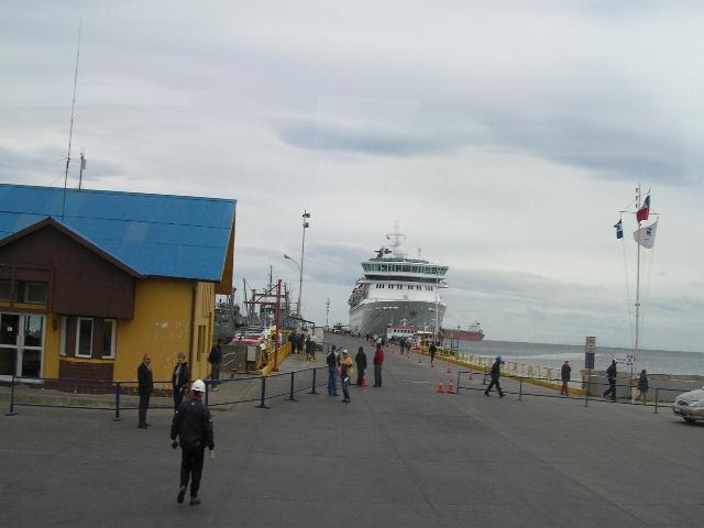 In
the mid-19th century, Chile used Punta Arenas as a penal colony
and a disciplinary posting for military In
the mid-19th century, Chile used Punta Arenas as a penal colony
and a disciplinary posting for military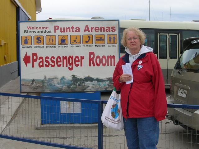 personnel with "problematic"
behavior, as well as a place for
immigrant
colonization. In December
1851, a
prisoners' mutiny led by Lieutenant Cambiaso, resulted in the murder of
Governor Muñoz Gamero and the priest, and the destruction of the church
and the hospital. personnel with "problematic"
behavior, as well as a place for
immigrant
colonization. In December
1851, a
prisoners' mutiny led by Lieutenant Cambiaso, resulted in the murder of
Governor Muñoz Gamero and the priest, and the destruction of the church
and the hospital.
The mutiny was put down by
Commander Stewart
of
HMS Virago
assisted by two Chilean ships: Indefatigable and Meteoro.]
In
1877 a mutiny,
known as "El motín de los artilleros" (Mutiny of the
Artillerymen) led to the destruction of a large part of the town and the
murder of many civilians not directly associated with the prison. In
time the city was restored and with the growth of the sheep industry and
the discovery of gold, as well as increasing trade via sailing ships,
began to prosper. discovery of gold, as well as increasing trade via sailing ships,
began to prosper.
Between about
1890 and
1940, the
Magellan's region
became one of the world's most important sheep-raising regions, with one
company (Sociedad Explotadora de Tierra del Fuego) controlling
over 10,000 square kilometres in southern Chile and Argentina. The
headquarters of this company and the residences of the owners were in
Punta Arenas.
Visitors today can get a
glimpse of the economic stature of the city,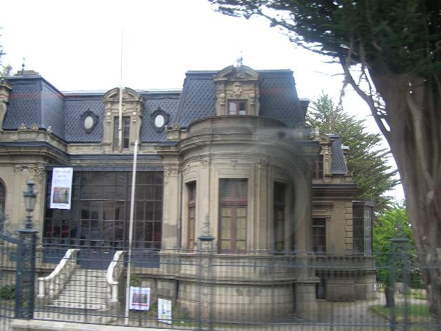 or at least of its leading
citizens, by touring the Sarah Braun museum (sometimes called Braun-Menéndez
mansion) in the centre of Punta Arenas. or at least of its leading
citizens, by touring the Sarah Braun museum (sometimes called Braun-Menéndez
mansion) in the centre of Punta Arenas.

Other popular attractions
include the two nearby rookeries for
Magellan penguins,
and the rebuilt site of the failed Fuerte Bulnes settlement.
Th e Punta Arenas harbor, although
exposed to storms, was considered one of the most important in Chile
before the construction of the
Panama Canal,
because it was used as a
coaling station
by the steamships transiting between the Atlantic and
Pacific Oceans.
Today it is mostly used by tourism cruises and scientific expeditions.
The city is often a jumping-off point for Antarctic expeditions,
although
Ushuaia
(Argentina) and
Christchurch (New
Zealand) are also
common starting points. e Punta Arenas harbor, although
exposed to storms, was considered one of the most important in Chile
before the construction of the
Panama Canal,
because it was used as a
coaling station
by the steamships transiting between the Atlantic and
Pacific Oceans.
Today it is mostly used by tourism cruises and scientific expeditions.
The city is often a jumping-off point for Antarctic expeditions,
although
Ushuaia
(Argentina) and
Christchurch (New
Zealand) are also
common starting points. Punta Arenas has a population of over
154,000 inhabitants (2008).
The city has its roots among the population origin of the European
colonists (Croatian
and
Spanish) that
populated the area at mid- nineteenth century. You can also mention some
colonies of descendants of people from other countries (i.e.
German,
English,
Italian,
Swiss
and others). nineteenth century. You can also mention some
colonies of descendants of people from other countries (i.e.
German,
English,
Italian,
Swiss
and others).
Croatian immigration
in Punta Arenas was a crucial development in the region of
Magellan's and
the city in particular. Currently, you can see this influence in the
names of shops and many buildings. According to some references to 50%
of the population of Punta Arenas would be
descendants of Croats.
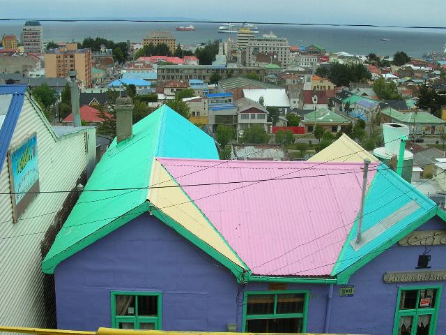
 The most important are the port,
the oil industry and trade and services, followed by livestock, mostly
sheep, fishing and forestry. Depart from Punta Arenas that address some
cruises to Antarctica, and its port reaching the majority of
European and
transatlantic cruise tours as well as flights from the airport to leave
the Falkland Islands, Antarctica and the rest of the country with daily
flights to the capital
Santiago and
other cities such as
Puerto Montt and
Concepción. The most important are the port,
the oil industry and trade and services, followed by livestock, mostly
sheep, fishing and forestry. Depart from Punta Arenas that address some
cruises to Antarctica, and its port reaching the majority of
European and
transatlantic cruise tours as well as flights from the airport to leave
the Falkland Islands, Antarctica and the rest of the country with daily
flights to the capital
Santiago and
other cities such as
Puerto Montt and
Concepción.
Punta Arenas has a
semi-arid,
ocean-moderated climate. The seasonal
temperature
in Punta Arenas is greatly moderated by its proximity to the
ocean, with specifying average lows in July near −1 °C (30.2 °F)
and highs in January of 14 °C (57 °F). This is not to say that
it is known for stable
 constant temperatures, only small
variability with season. Rainfall is most plentiful between
April and May and snow season goes all through
Chilean
winter (June till September), although the average temperature
does not descend below the 1°C.
Among
Chileans the city is also known for its strong winds (up to
130 km/hour). Winds tend to be strongest during the summer when
city officials put up ropes in the downtown area to assist with
unique wind currents created by the buildings. constant temperatures, only small
variability with season. Rainfall is most plentiful between
April and May and snow season goes all through
Chilean
winter (June till September), although the average temperature
does not descend below the 1°C.
Among
Chileans the city is also known for its strong winds (up to
130 km/hour). Winds tend to be strongest during the summer when
city officials put up ropes in the downtown area to assist with
unique wind currents created by the buildings.
Since
1986,
Punta Arenas has been the first significantly populated city in
the world to be directly affected by the hole in the
ozone layer,
exposing its residents to potentially damaging levels of
ultraviolet radiation.
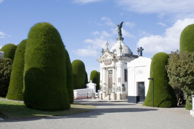
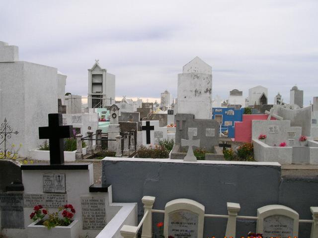
Punta Arenas Cemetery Entrance
Punta Arenas Cemetery Vaults
Punta Arenas Cemetery Graves

Puerto Montt

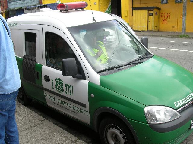
 Puerto
Montt is a port city and commune in southern
Chile,
located at the Puerto
Montt is a port city and commune in southern
Chile,
located at the  northern end of the
Reloncaví Sound
in the
Llanquihue Province,
Los Lagos Region.
It has a population of 153,118 (city only, 2002
census) and a city area of 39.58 km².It is 1 055
km to the south of the capital of the country,
Santiago. northern end of the
Reloncaví Sound
in the
Llanquihue Province,
Los Lagos Region.
It has a population of 153,118 (city only, 2002
census) and a city area of 39.58 km².It is 1 055
km to the south of the capital of the country,
Santiago.
Puerto Montt
is at the southern end of the Pan American highway in
Chile, Puerto Montt is not only the end of the road, but
the beginning of the fabled land of fjords, canals,
islands, snow-capped volcanoes, fertile agricultural
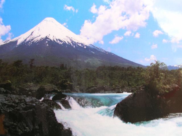 fields, green forested hills and the enchantment of
Southern Chile. (see
map.)
The Carratera Austral begins here on its rough route
south through Patagonia. fields, green forested hills and the enchantment of
Southern Chile. (see
map.)
The Carratera Austral begins here on its rough route
south through Patagonia.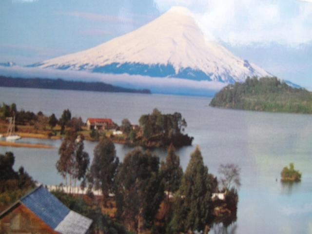
Likened to Seattle
and Vancouver, but not as spectacularly scenic, Puerto
Montt overlooks water, in this case the Bay and Estuary
of Reloncavi. It is a good base point for trips around
the area.
Named for Manuel Montt,
president when Puerto Montt was established in 1853, the port city is
the capital of Region XX, Los Lagos. As such, it is the center of
commercial fishing, agriculture, tourism and is imbued with the culture
and architecture of early German settlers.
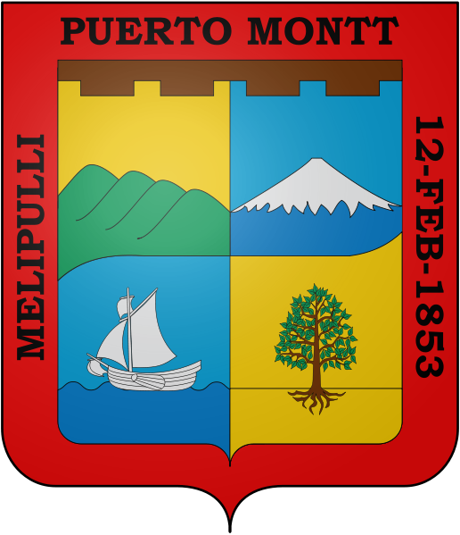
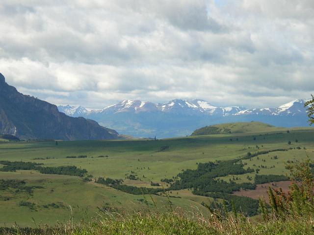 Originally, the site was covered by a
thick forest and was called Originally, the site was covered by a
thick forest and was called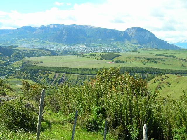 Melipulli (Means Four hills
in
Mapudungun).
It was selected as an entrance to
Lake Llanquihue
when its proximity to the open sea was discovered. In the
summer of 1851, an expedition arrived from Chiloé to begin
the clearing of the area and the building of houses for the
new inhabitants. The city itself was founded on February 12,
1853, after government-sponsored immigration from
Germany
that began in 1848 populated the region and integrated it
politically to the rest of the country. It was named after
Manuel Montt,
President of Chile
between 1851 and 1861, who set in motion the German
immigration. Melipulli (Means Four hills
in
Mapudungun).
It was selected as an entrance to
Lake Llanquihue
when its proximity to the open sea was discovered. In the
summer of 1851, an expedition arrived from Chiloé to begin
the clearing of the area and the building of houses for the
new inhabitants. The city itself was founded on February 12,
1853, after government-sponsored immigration from
Germany
that began in 1848 populated the region and integrated it
politically to the rest of the country. It was named after
Manuel Montt,
President of Chile
between 1851 and 1861, who set in motion the German
immigration.
 On March 4, 1969,
approximately 90 landless squatters decided to settle on On March 4, 1969,
approximately 90 landless squatters decided to settle on otherwise unoccupied farmland — without any title, right, or
payment of rent — belonging to an absentee landlord. The
squatters received advice from
Socialist
member of parliament
Luis Espinoza due to the local authority never granting them
any land they wanted to build houses. Five days later, local
Police Chief
Rolando Rodríguez Marbán reassured the squatters that they
would not be disturbed and could proceed with their home
construction. However, new orders received from the ministry
of the interior the following day led to a
 change of plans:
At midnight on
March 9,
Espinoza was charged with breaking the law, arrested, and
moved to the city of
Valdivia.
At dawn, 250 change of plans:
At midnight on
March 9,
Espinoza was charged with breaking the law, arrested, and
moved to the city of
Valdivia.
At dawn, 250 policemen launched an assault on the squatters,
following direct orders from Interior Minister Edmundo Pérez
Zujovic. The final result was that all newly-built homes
were burned to the ground and 11 squatters were shot dead. policemen launched an assault on the squatters,
following direct orders from Interior Minister Edmundo Pérez
Zujovic. The final result was that all newly-built homes
were burned to the ground and 11 squatters were shot dead.
The massacre of Puerto
Montt and the public outcry that followed were major factors
contributing to the fall of
Eduardo Frei's
government, which was succeeded by
Salvador Allende's
Unidad Popular
in the next year's elections.
The events were described by singer-songwriter
Víctor Jara
in his song
Preguntas por Puerto Montt.
 The famed and
spectacularly beautiful year-round
Cruce de Lagos:
from The famed and
spectacularly beautiful year-round
Cruce de Lagos:
from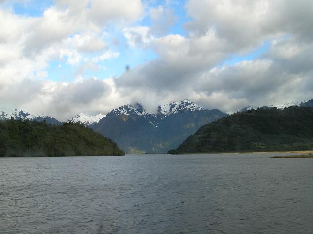 Puerto Montt to Bariloche, Argentina, crossing Todo los
Santos Lake in Vicente Perez Rosales National Park by luxury
catamaran, then by bus through an Andean pass, and then back
to the water on two Argentinian lakes. This is a two-day
trip and one not to be missed. Puerto Montt to Bariloche, Argentina, crossing Todo los
Santos Lake in Vicente Perez Rosales National Park by luxury
catamaran, then by bus through an Andean pass, and then back
to the water on two Argentinian lakes. This is a two-day
trip and one not to be missed.
 Navimag three day
cruises via the
fjords to Puerto Natales. There are shorter
cruises to Laguna San Rafael, and car/passenger ferries to Navimag three day
cruises via the
fjords to Puerto Natales. There are shorter
cruises to Laguna San Rafael, and car/passenger ferries to Puerto Chacabuco/Coyhaique.
Tour
Parque Nacional Alerce Andino,
protecting national forests,
Parque Nacional Hornopirén for
skiing on the volcano of the same name, and of course, a
visit to
Parque Nacional Chiloé.
Chiloé Island
is South America's largest island, and offers varying
attractions to the visitor: the scenery of course, sports
such as sea kayaking, walking, fishing, plus a rich
mythology of legends and sea monsters, buildings on stilts
at water's edge, called palafitos, and colorful
wooden churches. And, of course, casinoes.



Valdiva

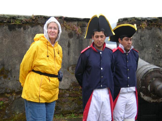
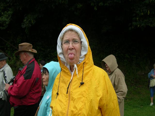 When we first arrived in
Valdiva, it was raining cats and dogs. We decided When we first arrived in
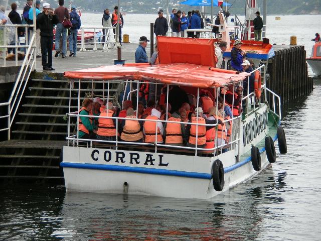
Valdiva, it was raining cats and dogs. We decided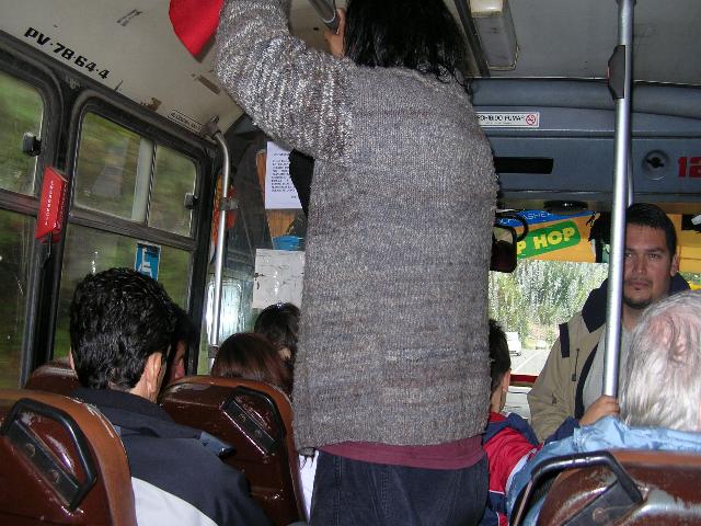 to
take the tender into Valvdiva anyway and see whatever we
could see as we had no formal excursion planned. Lois
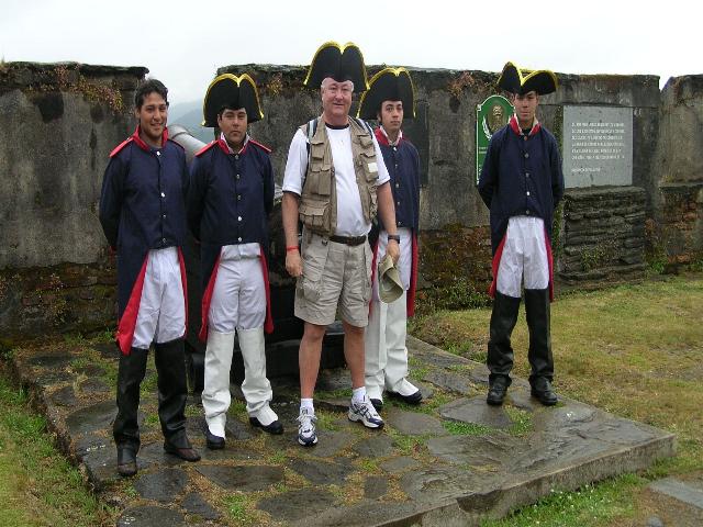
and I visited a fort that was used by the Spanish and Lois
spent some time down on the docks at the market looking at
local crafts and bought some raw wool for our daughter, Dawn
who is into spinning, etc. I, however decided to venture out
on my own and head for town. to
take the tender into Valvdiva anyway and see whatever we
could see as we had no formal excursion planned. Lois
and I visited a fort that was used by the Spanish and Lois
spent some time down on the docks at the market looking at
local crafts and bought some raw wool for our daughter, Dawn
who is into spinning, etc. I, however decided to venture out
on my own and head for town.
 I
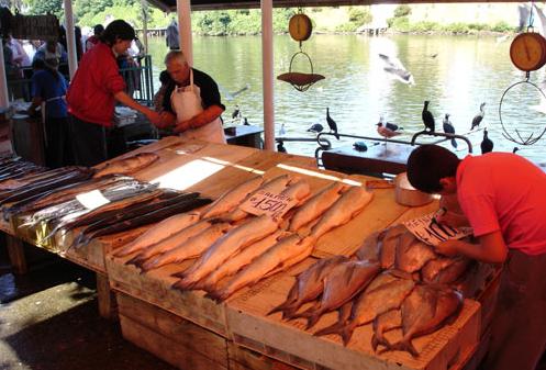
had a great time. I rode the ferry (cost 3 dollars U$)
about 6 or 7 miles (with many stops picking-up and
letting-off locals) to the main town. I went to the market,
to the restaurant and rode a local bus from where the ferry
left me off (in the middle of nowhere) for 1 U$ dollar. I
had a great time. I rode the ferry (cost 3 dollars U$)
about 6 or 7 miles (with many stops picking-up and
letting-off locals) to the main town. I went to the market,
to the restaurant and rode a local bus from where the ferry
left me off (in the middle of nowhere) for 1 U$ dollar.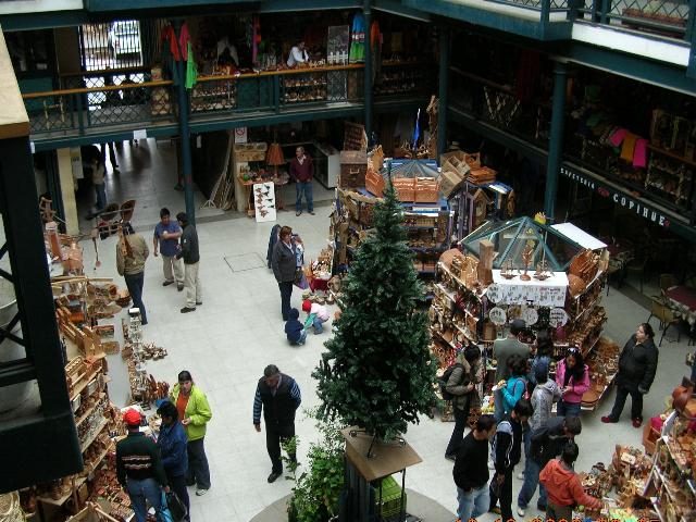
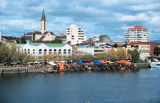
Valdivia, Chile, the
City of Rivers, was founded on the Bahía de Corral by
Pedro_de_Valdivia
on February 9, 1522
who named the new settlement Santa María la Blanca de
Valdivia.
 Taking advantage Of the harbor, the rivers and
the strategic location for ships rounding Cape Horn or
navigating the Strait of Magellan on the route to Lima and
the Viceroyalty of Peru, the founding fathers were pleased
to find the area rich in timber and gold. Taking advantage Of the harbor, the rivers and
the strategic location for ships rounding Cape Horn or
navigating the Strait of Magellan on the route to Lima and
the Viceroyalty of Peru, the founding fathers were pleased
to find the area rich in timber and gold.
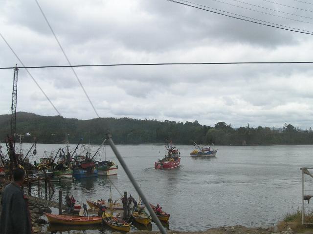
Valdivia became an important port
known as the La Perla del Sur , Southern Pearl, an
enviable asset of the Spanish crown. To protect Valdivia and
Bahía de Corral, Spanish forces began building
forts
in 1645, constructing the castillos at Mancera, Corral,
Niebla, Amargos and Cruces, and among others, the forts of
San Carlos and El Molino. Valdivia became the most heavily
fortified port in the Spanish colonies.
 In addition to repelling any foreign
forces and pirates intending to take theSouthern Pearl for
themselves, the locals had to fight the Mapuche nation who
were understandably upset with this invasion of their
homelands. The forts were also intended to keep the route
between Santiago and other cities open. In 1553/1554 In addition to repelling any foreign
forces and pirates intending to take theSouthern Pearl for
themselves, the locals had to fight the Mapuche nation who
were understandably upset with this invasion of their
homelands. The forts were also intended to keep the route
between Santiago and other cities open. In 1553/1554 the Mapuches rebelled and according to legend, Pedro de Valdivia
was captured, Impaled on a stake and his heart cut into
pieces and eaten by the Mapuche leader,
Lautaro. the Mapuches rebelled and according to legend, Pedro de Valdivia
was captured, Impaled on a stake and his heart cut into
pieces and eaten by the Mapuche leader,
Lautaro.
 Even after Chile separated from Peru
and attained independence from Spain, this area of Chile
remained loyal to the Spanish crown. It took a surprise
attack from
Lord Cochrane
and the Chilean navy to conquer the city and formally annex
it to Chile in 1821. Even after Chile separated from Peru
and attained independence from Spain, this area of Chile
remained loyal to the Spanish crown. It took a surprise
attack from
Lord Cochrane
and the Chilean navy to conquer the city and formally annex
it to Chile in 1821.
In the latter part of the
19th century, an influx of German emigrants moved to the
area during a national immigration program. They revitalized
the economy, brought in new industry, including breweries,
and made their mark in local architecture with their
distinctive styles.
In 1960, Valdivia was near the
epicenter of a 9.5 earthquake, termed the Largest Earthquake
in the World. The resulting tsunamis were felt across the
Pacific Ocean. Fortunately, the fatalities weren’t as high
as they could have been, but much of Valdivia and nearby
historic forts were destroyed. The river courses changed and
where the earth sank, the resulting flooding created an
aquatic area now maintained as the wetlands of the Santuario
de la Naturaleza Carlos Anwandter.


Concepción

Concepción was founded by
Pedro de Valdivia
in 1550 north of the
Bío-Bío River, at
the site which is today known as
Penco. At that
time it was given the name Concepción del Nuevo Extremo. The new
settlement of Concepción was just a few kilometers north of
La Frontera (The
Frontier), the boundary between
Spanish territory
and the land of the
Mapuche,
an American Indian ethnic group that remained independent until the
1870s. The settlement was formally recognized by the Spanish authorities
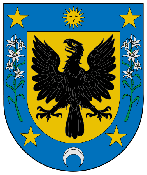
as a town two years later by a royal decree. It was given a coat-of-arms
that is still in use today.
Although Concepción was a significant
military settlement for the
Captaincy-General of Chile,
it was overrun and destroyed by
Mapuche armies in
1554, and once again after being refounded in 1555. Concepción was
restored during the governorship of
García Hurtado de Mendoza
when he landed there and built a fort on the Alto de Pinto in 1557. The
town was refounded once more on January 6, 1558, by captain Jerónimo de
Villegas. It became the headquarters of the military forces engaged
against the
Mapuche in
Araucanía over
the next two centuries, growing to a population of 10,000 despite a
siege in 1564 and
other attacks by the Mapuche. Concepción was the home of the
Real Audiencia
from 1565 to 1575.
Earthquakes
and
tsunamis, which
razed the town in
1570, 1657, 1687,
1730 and
1751, led the
authorities to move the town to its current site in the
Valle de la Mocha,
alongside the
Bío-Bío River;
the old site lay empty until March 29, 1842, when the present town of
Penco was founded.
The new site for the town of
Concepción became the main town of the Intendancy of Concepción, whose
jurisdiction extended from the
Maule River to La
Frontera. The first Intendant of Concepción was the Irishman
Ambrose O'Higgins, Marquis of Osorno,
who later became
Royal Governor of Chile
and
Viceroy of Peru.
When the First National Government
Board met in
Santiago on
September 18, 1810, citizens of Concepción joined up. Concepción was
used as the point of entry by the Spanish Army in the attempt by the
Viceroyalty of Peru
to re-conquer Chile. Concepción politicians and soldiers became a
significant political force in the newly-independent country.
On January 1, 1818, Ambrose
O'Higgins's son,
Bernardo O'Higgins,
proclaimed and took the oath of the
Chilean War of Independence
in the main square of Concepción, which since then has been known as
"Plaza de la Independencia". On February 20, 1835, the town again was
largely destroyed by an earthquake and had to be rebuilt.
As of 2010, Concepción is the
second largest city of Chile. The
Universidad de Concepción,
founded in 1919, became the first private university in Chile. The
neighboring harbor of Talcahuano is the site of the largest naval base
in Chile.
Valparaiso


It should be noted
however, "In the context of Chile being a relatively safe
country, Valparaiso is amongst its more dangerous locales, like
many harbor cities around the world. The port area (called
"Puerto") is generally considered to be dangerous at night."
Nicknamed “The Jewel of the
Pacific”, Valparaíso was declared a world heritage site based
upon its improvised urban design and unique architecture. In
1996, the World Monuments Fund declared Valparaíso’s unusual
system of
funicular
elevators (highly-inclined cable cars) one of the world’s 100
most endangered historical treasures.
In 1998, grassroots
activists convinced the Chilean government and local authorities
to apply for UNESCO world heritage status for Valparaíso.
Valparaíso was declared a
World Heritage Site
in 2003, thanks to its historical importance, natural beauty
(large number of hills surrounding a picturesque harbour), and
unique architecture (particularly, a mix of 19th century styles
of housing).
Built upon dozens of steep hillsides overlooking
the Pacific Ocean, Valparaíso boasts a labyrinth of streets and
cobblestone alleyways, embodying a rich architectural and
cultural legacy. Valparaíso is protected as a
UNESCO World Heritage Site.
Landmarks include:
VIglesia de la Matriz
Sotomayor Square
Courthouse
The "4 season women",
bought by Francisco Echaurren in 1877, in Plaza de la
victoria
The late "Cafè Riquet"
which was a classic amongst "Porteños" or locals, along with
the otherevents that often take place at the Anibal Pinto
Square
The 16 remaining
"Funiculars", 15 public(national monuments)/ 1 private (that
belongs to "Hospital Carlos Van Buren"), of which at one
point there were up to 29 of them.
The Concepcion & Alegre
Historical District
The Bellavista hill,
which has the "Museo a Cielo Abierto" or "open sky museum".
Monument to
Admiral Lord Thomas Alexander
Cochrane, 10th Earl of Dundonald.
Monument to Manuel
Blanco Encalada, first Chilean President, Born in Buenos
Aires, Argentina
Valparaíso is the
birthplace of many historically significant figures,
including:
Major industries
include tourism, culture, and transport.
Approximately 50
international cruise ships call on Valparaíso during the
4-month Chilean summer. The port of Valparaíso is also
an important hub for shipping of container freight, and
exports of many products, including
wine,
copper,
and fresh
fruit.
A new
regional
Metro
system, opened to the public on 24 November 2005,
updated parts of the railroad that joined Santiago to
Valparaíso and cities in between (originally built in
1863). The new metro constitutes the so-called “fourth
stage” (“Cuarta Etapa” in Spanish) of Metropolitan
improvements. The metro railway extends along most of
Gran Valparaíso and is the second metro system in
operation in Chile (after Santiago’s), and includes an
underground section that crosses Viña del Mar’s
downtown.
Valparaíso’s road infrastructure
has been undergoing substantial improvement,
particularly with the completion of the
“Curauma — Placilla — La Pólvora”
freeway bypass, which will allow trucks to go directly
to the port facility over a modern highway and through
tunnels, without driving through the historic and
already congested downtown streets. In addition, roads
to link Valparaíso to San Antonio, Chile’s second
largest port, and the coastal towns in between (Laguna
Verde, Quintay, Algarrobo, and Isla Negra, for example),
are also under various degrees of completion. Travel
between Valparaíso and Santiago currently takes about 80
minutes via a modern toll highway.
Santiago
Santiago,
is the
capital
and largest city of
Chile,
and the center of its largest
conurbation
(Greater Santiago). It is located in the country's
central valley,
at an elevation of 520 m (1,706.04 ft)
above mean sea level.
Although Santiago is the capital,
legislative bodies
meet in the coastal town of
Valparaíso,
a one-hour drive to its west.
Chile's steady economic
growth has transformed Santiago into one of
Latin America's
most modern metropolitan areas, with extensive suburban
development, dozens of shopping centers, and impressive
high-rise architecture. It is an
Alpha World City
and has a very modern transport infrastructure, including the
steadily growing underground
Santiago Metro,
an effort at modernizing public bus transport and a
free flow
toll-based ring road and inner city highway system, part of
which is tunneled underneath a large section of the city's main
river
Mapocho
connecting the Eastern and Western extremes of the city in a
25-minute drive. Santiago is the regional headquarters to many
multinationals, and a financial center.
The 1930s saw
the beginning of a transformation of the city into a
modern, industrialized one. Surrounding the Presidential
Palace (La
Moneda) was the
administrative district Barrio Cívico with many
ministries and other public facilities. The population
increased due to migration from northern and southern
Chile and by the 1940s it had exceeded the milestone of
a million inhabitants. Migration continued and by the
year of 1960 Santiago's population had doubled to two
million inhabitants. This
fast increase in population led to poverty, especially
in the poor neighborhoods of the city.
Santiago in the 20th Century
In the
following decades, Santiago flourished and continued to
grow rapidly. In 1940 the
city contained 952,075 inhabitants, rising to 1,350,409
in 1952 and reaching 1,907,378 by 1960 according to the
census of that year. This
growth was reflected in the urbanization of rural areas
on the periphery of the city, middle-class families
settling into low and stable housing. In 1930 the urban
area had an area of 6,500 hectares, increasing to 20,900
by 1960 and 38,296 by 1980. Although most of the
communities continued to grow, it was mainly
concentrated in outlying communities such as Canyon to
the west, the north of the city and "Conchalí", "Las
Cisternas" and "La Granja" to the south; the more
wealthy sections of society became concentrated in areas
such as Las Condes and La Reina. In contrast, the centre
gradually decreased in population, leaving more space
for the development of trade, banking and government
activities.
This growth
took place without any regulation, this only beginning
to be implemented during the 1960s with the creation of
various development plans for
Greater Santiago,
reflecting the new reality of a much larger city. In
1958 a plan was launched in Santiago which proposed the
organization of urban territory, setting a limit of
38,600 hectares for a maximum population of 3,260,000
inhabitants. New roads (such as the Avenida Américo
Vespucio Ring-road and the Pan American highway) were
constructed and existing industrial centers enlarged and
new ones established. The hosting of the
World Cup
in 1962 gave new impetus to the improvement works of the
city. In 1966 the Metropolitan Park of Santiago was
established in the Cerro San Cristóbal and MINVU began
eradicating shanty towns and construction of new homes
and remodeling San Borja, which was built near the Diego
Portales Building.
The new
International Airport Pudahuel opened in 1967 and, after
years of discussion, in 1969 construction of the Metro
de Santiago began, the first phase running under the
western section of the Alameda and being inaugurated in
1975. The Metro was very successful and in subsequent
years expanded, comprising two perpendicular lines by
the end of 1978. Telecommunications have been an
important development as reflected by the construction
of the Torre Entel, which since its construction in 1975
would be one of the symbols of the capital and the
tallest structure in the country for two decades.
After the
coup of 1973 and the establishment of the military
regime, urban planning had no major changes until the
beginning of 1980, when the government adopted a
neoliberal economic model and took on the role of
supervisor of a market economy. In 1979 the master plan
was amended, extending the urban area to more than
62,000 hectares. Expansion has been particularly acute
in La Florida where, according to the 1992 census, was
the country's most populous municipality with 328,881
inhabitants. Meanwhile, a strong
earthquake
struck the city on March 3, 1985, causing few casualties
but leaving many homeless and destroying many old
buildings. Another struck on February 27, 2010 leaving
dozens dead.
Economic crisis and recovery
Starting in
1981, Santiago (and Chile as a whole), went into a deep
economic and financial crisis. The Chilean solution to
the crisis was heterodox in the sense that many policies
appeared to have been arbitrary, and policy mistakes
were made and corrected along the way. However, the
economy recovered relatively quickly, and since has
built a strong financial sector that allowed the country
to avoid the financial turmoil observed during 1995 and
1997-98 in other emerging market economies.
On Saturday, February 27, 2010
an 8.8 magnitude earthquake
struck in the south of Chile, causing massive
destruction in many places, however because of good
quality buildings not much damage was recorded in
Santiago.
Geography
The city lies
in the centre of the Santiago Basin, a large
bowl-shaped valley consisting of a broad and fertile
plain surrounded by mountains. It is flanked by the main
chain of the
Andes
on the east and the
Chilean Coastal Range
on the west. On the north, it is bound by the Cordón
de Chacabuco, a transverse mountain range of the
Andes, whereas at the southern border lies Angostura
de Paine, where an elongated spur of the Andes
almost reaches the Coastal Range. Santiago Basin is part
of the
Intermediate Depression
and is remarkably flat, interrupted only by a few hills.
Among those are
Cerro Renca,
Cerro Blanco
and
Cerro Santa Lucía.
The Andes
mountains around Santiago are quite tall, culminating in
Tupungato
volcano at 6,570 m (21,555 ft). Other volcanoes include
Tupungatito,
San José
and
Maipo.
Cerro El Plomo
is the highest mountain visible from Santiago's urban
area.
Santiago is
situated mainly on a plain known as the Santiago basin.
This basin is part of the Intermediate Depression and is
clearly delimited by the string of Chacabuco in the
north, the
Andes
Mountains in the east, the narrowness of Paine in the
south and the
Cordillera
de la Costa. It is approximately 80 km in a north-south
direction and 35 km from east to west.
For hundreds
of millions of years, the current territory of the city
was covered by the ocean and marine sediment, the only
land mass near the existing Coastal Cordillera. The
morphology of the region begin to take its present form
since the late
Paleozoic,
when it begins the subduction of the
Nazca Plate
under the South American plate, then belonging to the
continent of Gondwana. This subduction generated
foldings of the crust from the Triassic, lifting the
rocks that give rise to the Andes. Subsequently, new
activities generate tectonic subsidence of the great
rock mass forming the depression lifted.
At present,
Santiago lies mainly in the plain of the basin, with an
altitude between 400 in the western areas and reaching
the 540 on the Plaza Baquedano,
presented some hills in the area of Cerrillos. The
metropolitan area has surrounded some of these islands,
mountains, as in the case of Cerro Santa Lucia, Cerro
Blanco, the Renca Calán and that 800 meters is the
highest point of the city. Southwest of the city there
is a string of rocky hills several islands within the
highlighting Cerro Chena. To the west are also presented
some of the main stage of the Cordillera de la Costa,
the Oak Hill High with 2185 meters of altitude, and the
Maipo River area alone in the mountain range loses
height. During recent decades, urban growth has expanded
the boundaries of the city to the east closer to the
Andean Precordillera. Even in areas such as La Dehesa,
Lo Curro and El Arrayan has been reached to overcome the
barrier of 1000 meters of altitude.
Some low-lying foothills of the Andes emerge and goes
into the basin, as is the If the mountain range of The
Pyramid and the hill Cerro San Cristobal, in the
northeastern sector of Santiago.
To the east,
stands the massive call Ramon Sierra, a mountain chain
formed in the foothills of the Precordillera due to the
action of the fault Ramon, reaching 3296 meters at the
Cerro de Ramon.
20 km further east is the Cordillera of the
Andes
with its mountain ranges and volcanoes, many of which
exceed 6,000 m (19,685.04 ft)
and in which some glaciers are maintained. The higher
the Tupungato volcano with 6570 meters, located
near the volcano Tupungatito of 5913 meters of altitude.
To the northeast lie Lead Hill (5,424 meters) and Nevado
El Plomo 6070 meters in altitude. To the southeast
of the capital, meanwhile, are located on the Nevado
Piuquenes (6,019 meters) volcano San Jose (5,856 m) and
the volcano Maipo (5,323 m). From these peaks, the
Tupungatito as San José and Maipo are active volcanoes.
Climate
Santiago has
a somewhat cooler
Mediterranean climate:
relatively hot dry summers (November to March) with
temperatures reaching up to 35 degrees Celsius (95
degrees Fahrenheit) on the hottest days; winters (June
to August) are more humid with cold mornings, typical
maximum daily temperatures of 13 degrees Celsius (56
degrees Fahrenheit), and minimums of a few degrees above
freezing. Occasional snowfall occurs in the city, and
may extend throughout the city, though this happens
infrequently (about every 8–10 years). Mean rainfall is
360 mm per year and is heavily concentrated in the
cooler months.
|
 Puerto
Montt is a port city and commune in southern
Chile,
located at the
  northern end of the
Reloncaví Sound
in the
Llanquihue Province,
Los Lagos Region.
It has a population of 153,118 (city only, 2002
census) and a city area of 39.58 km².It is 1 055
km to the south of the capital of the country,
Santiago.
 fields, green forested hills and the enchantment of
Southern Chile. (see
map.)
The Carratera Austral begins here on its rough route
south through Patagonia.


 foot here on October 21,
1520.
 In
the mid-19th century, Chile used Punta Arenas as a penal colony
and a disciplinary posting for military
 personnel with "problematic"
behavior, as well as a place for
 discovery of gold, as well as increasing trade via sailing ships,
began to prosper.
  or at least of its leading
citizens, by touring the Sarah Braun museum (sometimes called Braun-Menéndez
mansion) in the centre of Punta Arenas.
 e Punta Arenas harbor, although
exposed to storms, was considered one of the most important in Chile
before the construction of the
 nineteenth century. You can also mention some
colonies of descendants of people from other countries (i.e.
 The most important are the port,
the oil industry and trade and services, followed by livestock, mostly
sheep, fishing and forestry. Depart from Punta Arenas that address some
cruises to Antarctica, and its port reaching the majority of

 constant temperatures, only small
variability with season. Rainfall is most plentiful between
April and May and snow season goes all through


 Originally, the site was covered by a
thick forest and was called
 Melipulli (Means Four hills
in
 On March 4, 1969,
approximately 90 landless squatters decided to settle on
 otherwise unoccupied farmland — without any title, right, or
payment of rent — belonging to an absentee landlord. The
squatters received advice from
 change of plans:
At midnight on
 policemen launched an assault on the squatters,
following direct orders from Interior Minister Edmundo Pérez
Zujovic. The final result was that all newly-built homes
were burned to the ground and 11 squatters were shot dead.
 The famed and
spectacularly beautiful year-round
 Puerto Montt to Bariloche, Argentina, crossing Todo los
Santos Lake in Vicente Perez Rosales National Park by luxury
catamaran, then by bus through an Andean pass, and then back
to the water on two Argentinian lakes. This is a two-day
trip and one not to be missed.
  Navimag three day
cruises via the
fjords to Puerto Natales. There are shorter
cruises to Laguna San Rafael, and car/passenger ferries to
 Puerto Chacabuco/Coyhaique.


 When we first arrived in
Valdiva, it was raining cats and dogs. We decided
 to
take the tender into Valvdiva anyway and see whatever we
could see as we had no formal excursion planned. Lois
and I visited a fort that was used by the Spanish and Lois
spent some time down on the docks at the market looking at
local crafts and bought some raw wool for our daughter, Dawn
who is into spinning, etc. I, however decided to venture out
on my own and head for town.
 I
had a great time. I rode the ferry (cost 3 dollars U$)
about 6 or 7 miles (with many stops picking-up and
letting-off locals) to the main town. I went to the market,
to the restaurant and rode a local bus from where the ferry
left me off (in the middle of nowhere) for 1 U$ dollar.
 Taking advantage Of the harbor, the rivers and
the strategic location for ships rounding Cape Horn or
navigating the Strait of Magellan on the route to Lima and
the Viceroyalty of Peru, the founding fathers were pleased
to find the area rich in timber and gold.
  In addition to repelling any foreign
forces and pirates intending to take theSouthern Pearl for
themselves, the locals had to fight the Mapuche nation who
were understandably upset with this invasion of their
homelands. The forts were also intended to keep the route
between Santiago and other cities open. In 1553/1554
 the Mapuches rebelled and according to legend, Pedro de Valdivia
was captured, Impaled on a stake and his heart cut into
pieces and eaten by the Mapuche leader,
 Even after Chile separated from Peru
and attained independence from Spain, this area of Chile
remained loyal to the Spanish crown. It took a surprise
attack from


