|


| |

New Zealand
is a remarkable place. Lois and I love it there. The
Southern portion (a separate island) is a fantastic place as is the
very different Northern island and the awesome center of the island
nation is spectacular in every way.
New Zealand is
an
island country
located in the southwestern Pacific Ocean. The country
geographically comprises two main landmasses that of the
North and
South Islands
as well as numerous
smaller islands.
New Zealand is
situated some 900 miles east of Australia across the
Tasman Sea
and roughly 600 miles south of the
Pacific island nations
of
New Caledonia,
Fiji, and
Tonga.
Because of its remoteness, it was one of the last lands to be
settled by humans.
During its
long isolation, New Zealand developed a distinctive
biodiversity
of both animal and plant life. Most notable are the large number of
unique
bird species,
many of which became extinct after the arrival of humans and
introduced mammals.
With a mild maritime climate, the land was mostly covered in forest.
The country's varied topography and its sharp mountain peaks owe
much to the
tectonic uplift
of land and volcanic eruptions caused by the
Pacific and
Indo-Australian Plates
clashing beneath the earth's surface.
New Zealand
was one of the last major landmasses settled by humans.
Radiocarbon dating,
evidence of
deforestation
and
mitochondrial DNA
variability within
Māori
populations suggest New Zealand was
first settled by Eastern
Polynesians
between 1250 and 1300, concluding a
long series of voyages through the southern Pacific islands.
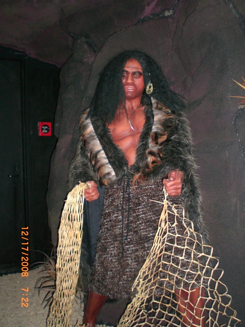
Over the centuries that followed these settlers developed a distinct
culture now known as Māori. The population was divided into
iwi
(tribes) and
hapū (subtribes)
which would cooperate, compete and sometimes fight with each other.
At some point a group of Māori migrated to the
Chatham Islands
(which they named Rēkohu) where they developed their distinct
Moriori
culture. The Moriori population was
decimated between 1835 and 1862, largely because of Māori invasion
and enslavement, although European diseases also contributed. In
1862 only 101 survived and the last known full-blooded Moriori died
in 1933.
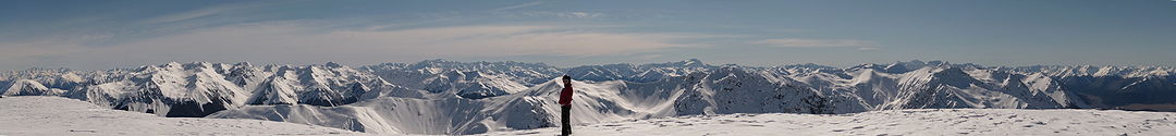
South Island
The South
Island
is the
larger of the two major
islands
of
New Zealand,
the other being the more populous
North Island.
It is bordered to the north by
Cook Strait,
to the west by the
Tasman Sea,
to the south and east by the
Pacific Ocean.
The territory of the South Island covers 58,384 sq miles
and is influenced by a
temperate climate.
The
South Island is sometimes called the "Mainland". While
it has a 33% larger landmass than the North Island, only
24% of New Zealand's 4.4 million inhabitants live in the
South Island. In the early stages of European settlement
of the country, the South Island had the majority of the
European population and wealth due to the 1860s
gold rushes.
The North Island population overtook the South in the
early 20th century, with 56% of the population living in
the North in 1911, and the drift north of people and
businesses continued throughout the century.
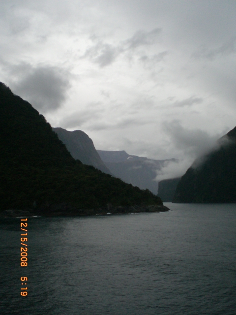
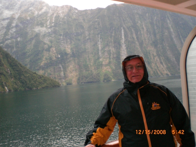
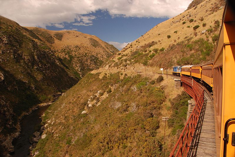
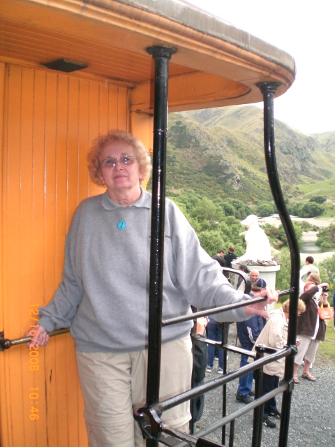
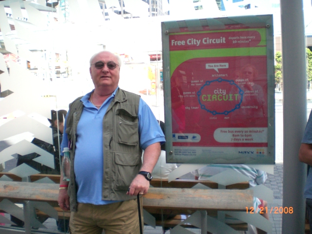
Dunedin
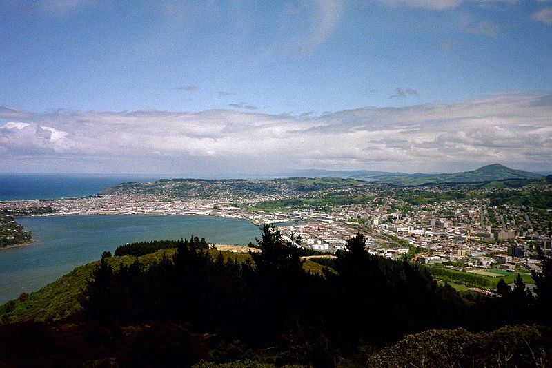
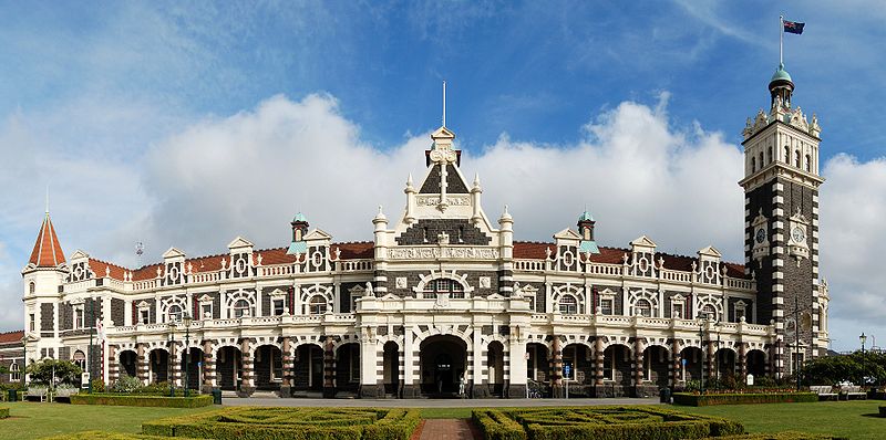
After we toured the South
Islands we headed for Dunedin.
We decided to use our time in
Dunedin by boarding the quaint
train to the Taieri Gorge at the
Dunedin train station (above).
It was a great trip. It
reminded me very much of going
through the Rocky Mountains in
it's ruggedness and innate
beauty. We had lunch and
tea on the train and at the very
top we were able to view where
Lord-of-the-Rings was filmed.
It is truly beautiful.
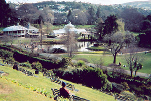
We also toured the Dunedin
Botanical Gardens (Below left).
  And
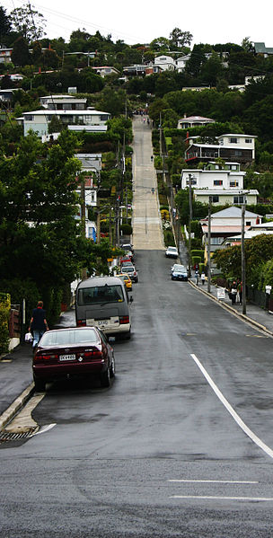
traveled up Baldwin Street into
the residential sections of
Dunedin. And
traveled up Baldwin Street into
the residential sections of
Dunedin.
Archaeological evidence shows
the first human (Māori)
occupation of New Zealand
occurred between AD 1250–1300,with
population concentrated along
the southeast coast.
A camp site at Kaikai's Beach,
near
Otago
Heads,
has been dated from about that
time.
There are numerous archaic (moa
hunter) sites in what is now
Dunedin, several of them large
and permanently occupied,
particularly in the 14th
century.
The population contracted but
expanded again with the
evolution of the Classic culture
which saw the building of
several
pā,
fortified settlements, notably
Pukekura at (Taiaroa
Head),
about 1650.
There was a settlement in what
is now central Dunedin (Ōtepoti)
occupied as late as about 1785
but abandoned by 1826.
Maori
tradition tells first of a
people called Kahui Tipua living
in the area, then Te Rapuwai,
semi-legendary but considered to
be historical. The next arrivals
were
Waitaha
followed by
Kāti Mamoe
late in the 16th century and
then
Kai Tahu
(Ngai Tahu in modern
standard
Māori)
who arrived in the mid 17th
century.
These migration waves have often
been represented as 'invasions'
in European accounts but modern
scholarship has cast doubt on
that. They were probably
migrations like those of the
European which incidentally
resulted in bloodshed.
The
sealer John Boultbee recorded in
the 1820s that the 'Kaika Otargo'
(settlements around and near
Otago
Harbour)
were the oldest and largest in
the south.

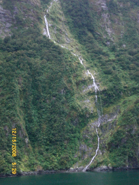
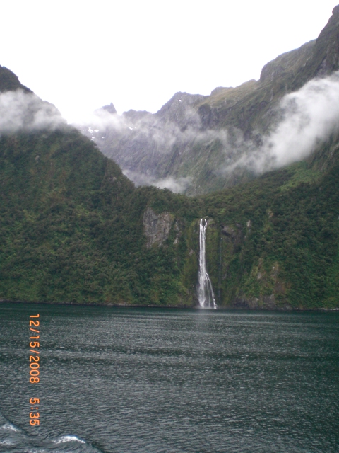
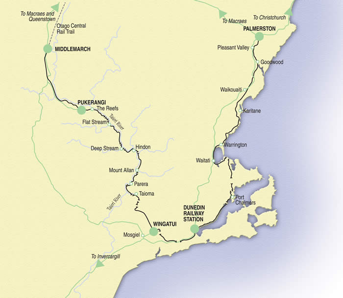
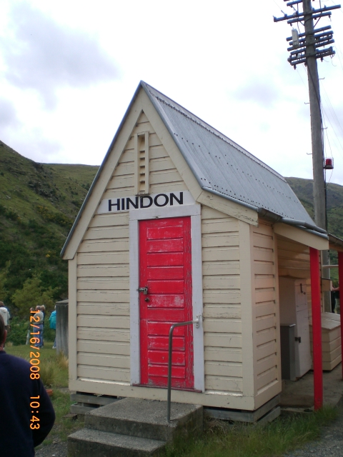
The AMAZING Taieri Gorge
The Taieri Gorge is
located on the
Taieri River,
in the
South Island
of
New Zealand.
It is a deep canyon carved by the Taieri
River on the middle stage of its journey
from
Central Otago
to the
Pacific Ocean,
between the high plateau of the
Maniototo
and the coastal
Taieri Plains.
The
Taieri Gorge Railway
runs alongside (and considerably above) the
river through the gorge.
Christchurch
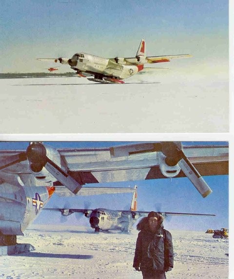
The first time I saw Christchurch
was in 1964. We were there to pick up supplies and personnel
for the McMurdo
Station in Antarctica. McMurdo Station is a
U.S.
Antarctic
research center located on the southern tip of
Ross Island,
which is in the New Zealand-claimed
Ross Dependency
on the shore of
McMurdo Sound
in
Antarctica.
It is operated by the United States through the
United States Antarctic Program,
a branch of the
National Science Foundation.
The station is the largest community in Antarctica, capable of
supporting up to 1,258 residents, and serves as the United States
Antarctic science facility. All personnel and cargo going to or
coming from
Amundsen–Scott South Pole Station
first passes through McMurdo.
Christchurch is the largest city in the
South Island
of
New Zealand,
and the country's third-largest
urban area.
It lies one third of the way down the South Island's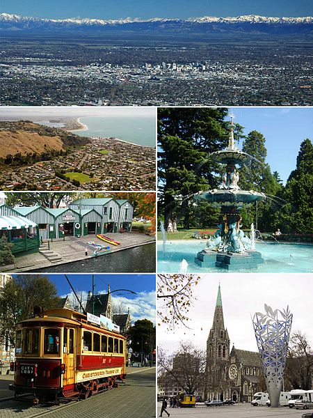 east coast, just north of
Banks Peninsula
which itself, since 2006, lies within the formal limits of
Christchurch.
east coast, just north of
Banks Peninsula
which itself, since 2006, lies within the formal limits of
Christchurch.
The
city was named by the
Canterbury Association,
which settled the surrounding province of
Canterbury.
The name of Christchurch was agreed on at the first meeting of the
association on 27 March 1848. It was suggested by
John Robert Godley,
who had attended
Christ Church, Oxford.
Some early writers called the town Christ Church, but it was
recorded as Christchurch in the minutes of the management
committee of the association. Christchurch became a city by Royal
Charter on 31 July 1856, making it officially the oldest established
city in New Zealand.
The
river that flows through the centre of the city (its banks now
largely forming an urban park) was named
Avon at the
request of the pioneering Deans brothers to commemorate the
Scottish Avon,
which rises in the Ayrshire hills near what was their grandfathers'
farm and flows into the Clyde.
The
usual
Māori
name for Christchurch is Ōtautahi ("the place of Tautahi").
This was originally the name of a specific site by the Avon River
near present-day Kilmore Street and the Christchurch Central Fire
Station. The site was a seasonal dwelling of
Ngāi Tahu
chief Te Potiki Tautahi, whose main home was
Port Levy on
Banks Peninsula. The Ōtautahi name was adopted in the 1930s. Prior
to that the Ngāi Tahu generally referred to the Christchurch area as
Karaitiana, a transliteration of
the English word Christian. The city's name is often abbreviated by
New Zealanders to Chch.
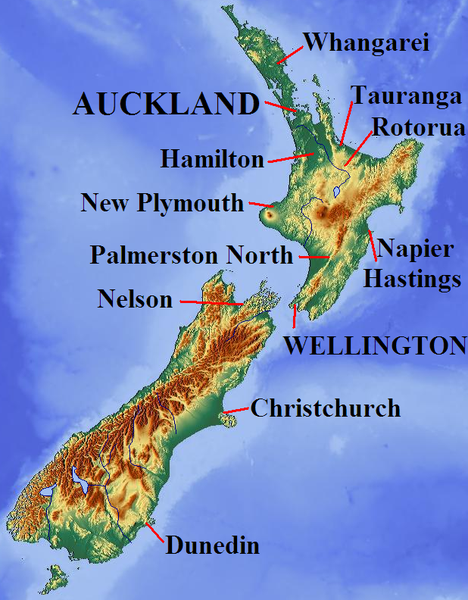
The North Island
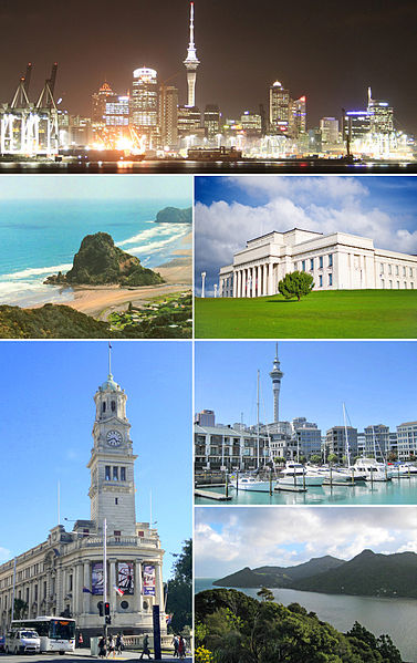
The Auckland metropolitan area, in
the
North Island
of
New Zealand,
is the largest and most populous
urban area in the country
with 1,377,200 residents, 31 percent of the country's
population. Auckland has
the largest
Polynesian
population of any city in the world.
In
Māori
Auckland's names are Tāmaki Makaurau, and the
transliterated version of Auckland, Ākarana.
The 2011
Mercer Quality of Living Survey
ranked Auckland 3rd equal place in the world on its
list, while the
Economist's
World's Most Livable Cities
index of 2011 ranked Auckland in 9th place. In 2010,
Auckland was classified as a
Beta World City
in the World Cities Study Group’s inventory by
Loughborough University.
Auckland lies between the
Hauraki Gulf
of the
Pacific Ocean
to the east, the low
Hunua Ranges
to the south-east, the
Manukau Harbor
to the south-west, and the
Waitakere Ranges
and smaller ranges to the west and north-west. The
central part of the urban area occupies a narrow
isthmus
between the Manukau Harbour on the
Tasman Sea
and the
Waitemata Harbor
on the
Pacific Ocean.
It is one of the few cities in the world to have
harbours on two separate major bodies of water.
Auckland
straddles the
Auckland Volcanic Field,
which has produced about 50 volcanoes. These take the form of cones,
lakes, lagoons, islands and depressions, and several have produced
extensive lava flows. Most of the cones have been partly or
completely
quarried
away. The individual volcanoes are all considered extinct, although
the volcanic field itself is merely
dormant.
Auckland has at least 14 large lava tube caves which run from the
volcanoes down towards the sea.
 Unlike
the explosive
subduction-driven
volcanism in
the central North Island, such as at
Mount Ruapehu
and
Lake Taupo,
Auckland's volcanoes are fuelled entirely by
basaltic
magma.
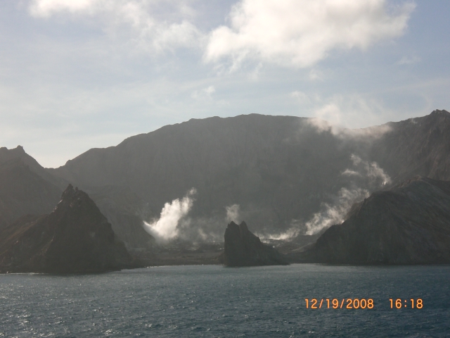
The most recent and by far the largest volcano,
Rangitoto Island
(Right), was formed within the last 1000 years, and its eruptions
destroyed the Māori settlements on neighbouring
Motutapu Island
some 700 years ago. Rangitoto's size, its symmetry, its position
guarding the entrance to
Waitemata Harbour
and its visibility from many parts of the Auckland region make it
Auckland's most iconic natural feature. Few birds and insects
inhabit the island because of the rich acidic soil and the type of
flora growing Unlike
the explosive
subduction-driven
volcanism in
the central North Island, such as at
Mount Ruapehu
and
Lake Taupo,
Auckland's volcanoes are fuelled entirely by
basaltic
magma.
The most recent and by far the largest volcano,
Rangitoto Island
(Right), was formed within the last 1000 years, and its eruptions
destroyed the Māori settlements on neighbouring
Motutapu Island
some 700 years ago. Rangitoto's size, its symmetry, its position
guarding the entrance to
Waitemata Harbour
and its visibility from many parts of the Auckland region make it
Auckland's most iconic natural feature. Few birds and insects
inhabit the island because of the rich acidic soil and the type of
flora growing
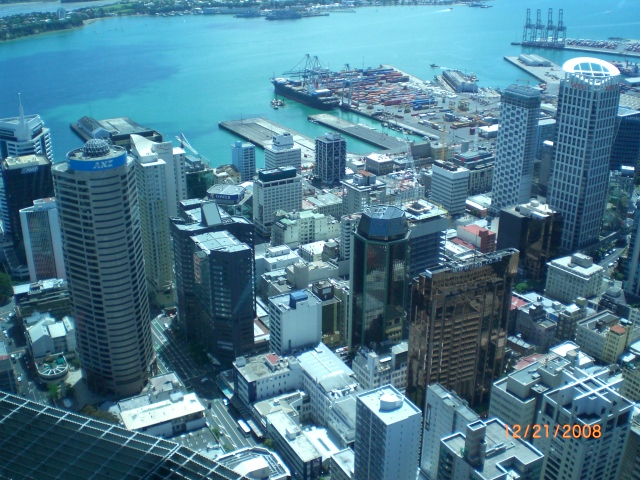
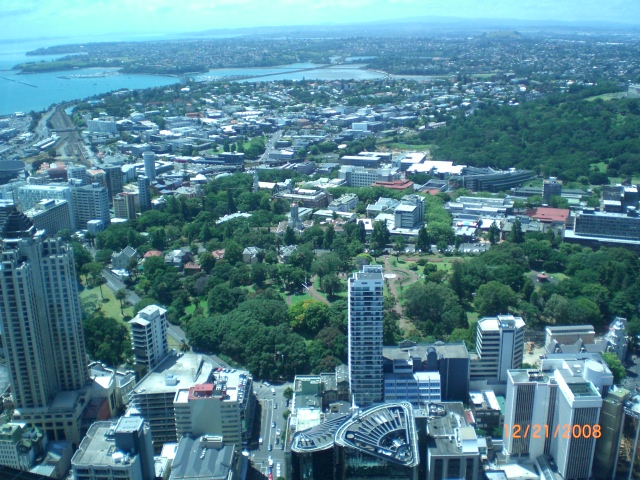
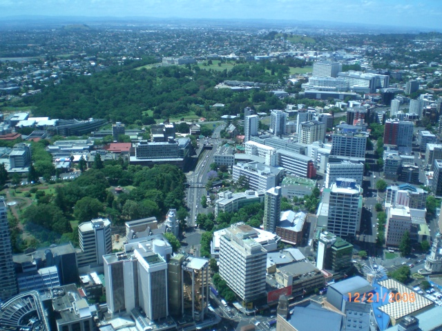
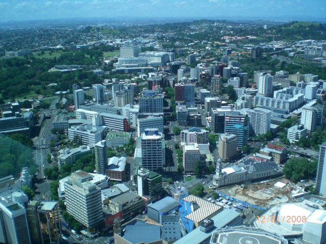
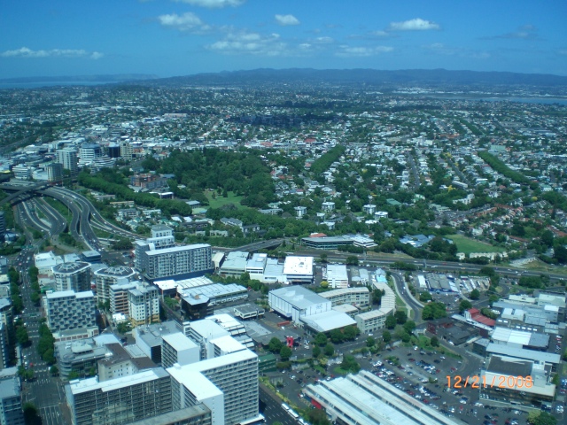
 Auckland
is a great city to visit. Lois and I spent considerable time
exploring the city Auckland
is a great city to visit. Lois and I spent considerable time
exploring the city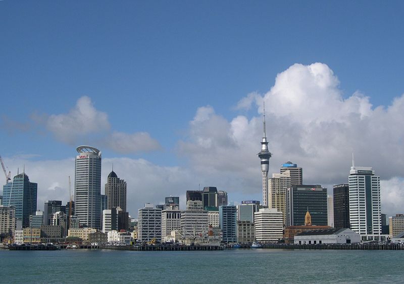 and the centerpiece seems to be the "Sky Tower.
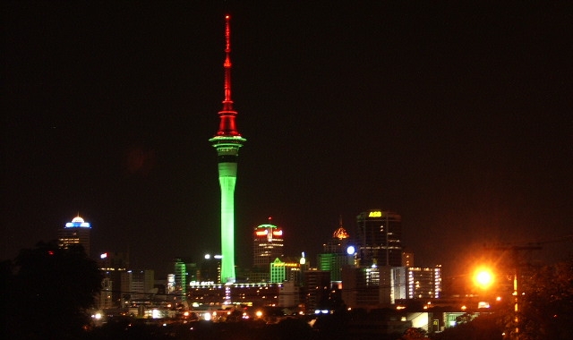
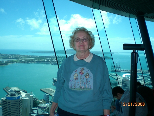
Here is a
photo of how this dominant structure looks at night and (left) how
it looms over the city in the daytime. We spent considerable
time in the tower for lunch and in the observation deck marveling at
the city and it's harbor sights. The views are spectacular to
say the least.
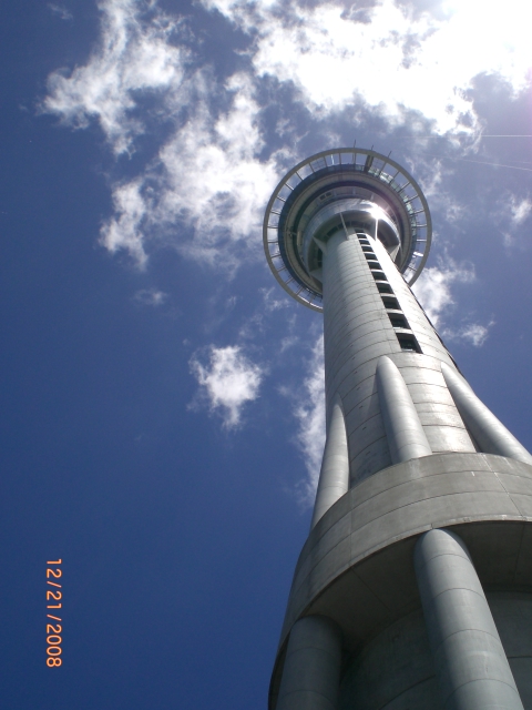
The
tower is part of the
SKYCITY Auckland
casino complex, originally built for
Harrah's Entertainment.
The tower attracts an average of 1,450 visitors per day
(over 500,000 per year).
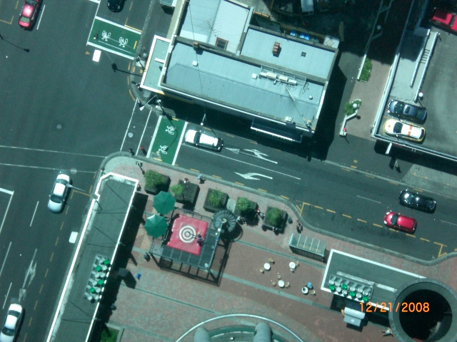
The
upper portion of the tower contains two restaurants and
a cafe — including New Zealand's only
revolving restaurant,
located 623.2 ft. from the ground, which turns 360
degrees once every hour.
There is also a brasserie-style buffet located one floor
above the main observatory level. It has three
observation decks at different heights, each providing
360-degree views of the city. The main observation level
at 610.08 ft. 1.5") thick glass sections of flooring
giving a view straight to the ground.
The top observation deck labeled 'Skydeck' sits just
below the main antenna at 721.6 ft. and gives views of
up to 50.84 miles in the distance.
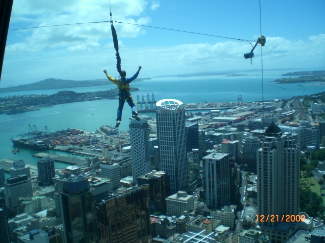
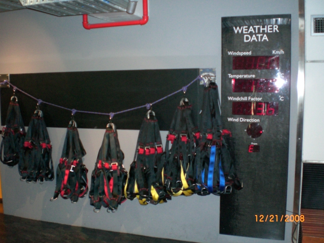
The tower also features the 'SkyJump', a 629.76 ft. jump
from the observation deck, during which a jumper can
reach up to 53 mph. The jump is guide-cable-controlled
to prevent jumpers from colliding with the tower in case
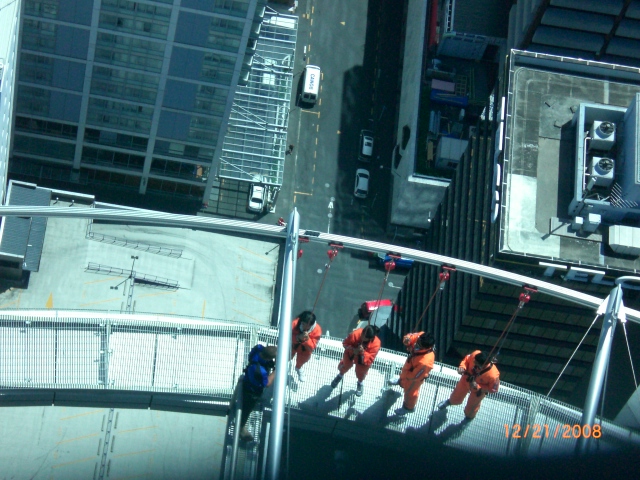
of wind gusts. Climbs into
the antenna mast portion 980 ft heights are also
possible for tour groups,
as is a walk around the exterior.
The tower is also used for telecommunications and
broadcasting with the
Auckland Peering Exchange
(APE) being located on Level 48.
The aerial at the top of the tower
hosts the largest
FM
combiner in the world
which combines with 58 wireless
microwave
links located above the top restaurant to provide a
number of services. These include
television,
wireless internet,
RT,
and
weather measurement services.

|
