


 The Argentine Republic
is the second largest country in
The Argentine Republic
is the second largest country in

 Buenos Aires increased its political power and influence because of this, and
became the region's chief port. In 1776, the
Buenos Aires increased its political power and influence because of this, and
became the region's chief port. In 1776, the

 Our
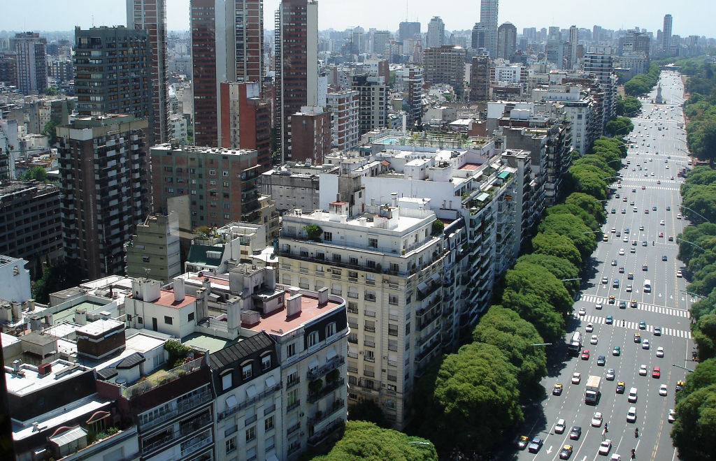
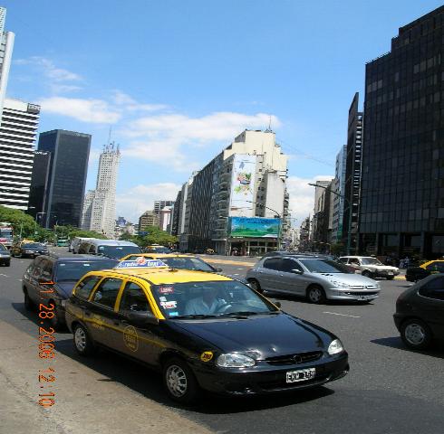
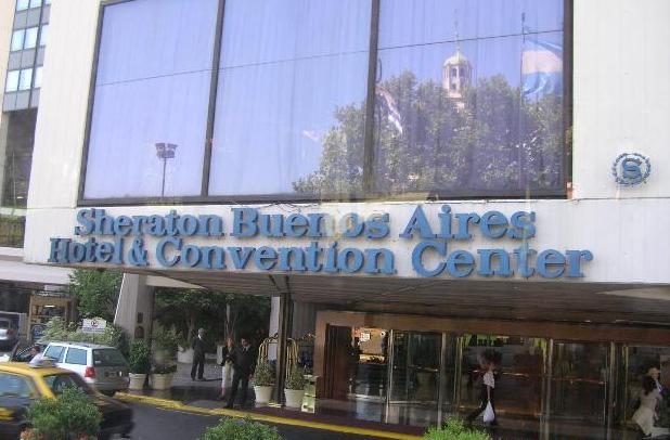
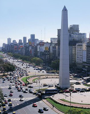
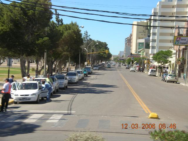
hotel was at the Five Star Sheraton located in downtown Buenos Aries
overlooking one of the busiest 12 lane city streets I've ever seen (Avenida
del Libertador Above right).
The taxi cabs are yellow and black in color and are everywhere. It
looked live a hive of angry bumble bees outside our hotel room. Traffic
jams are equal to the worst of New York, London or Paris.
Our
hotel was at the Five Star Sheraton located in downtown Buenos Aries
overlooking one of the busiest 12 lane city streets I've ever seen (Avenida
del Libertador Above right).
The taxi cabs are yellow and black in color and are everywhere. It
looked live a hive of angry bumble bees outside our hotel room. Traffic
jams are equal to the worst of New York, London or Paris. visited
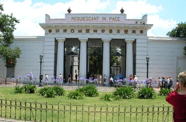
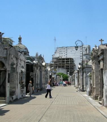
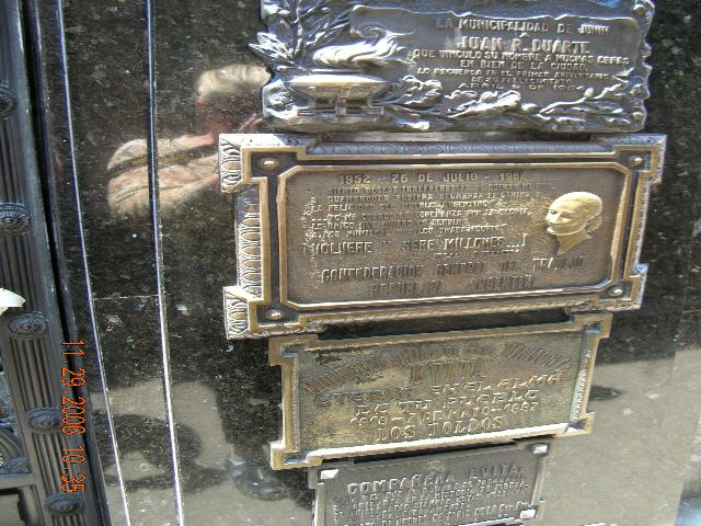
the graveyard of Eva Peron (it really is something to see, the graveyard
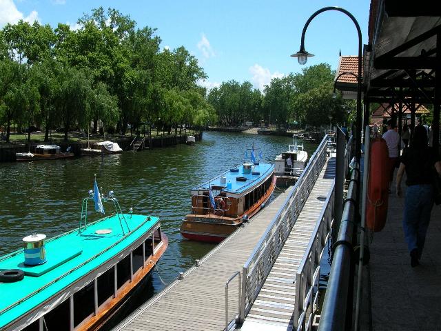
is built like a miniature city). We took a train trip (San Isidro)
through the better parts of Buenos Aires and
visited
the graveyard of Eva Peron (it really is something to see, the graveyard
is built like a miniature city). We took a train trip (San Isidro)
through the better parts of Buenos Aires and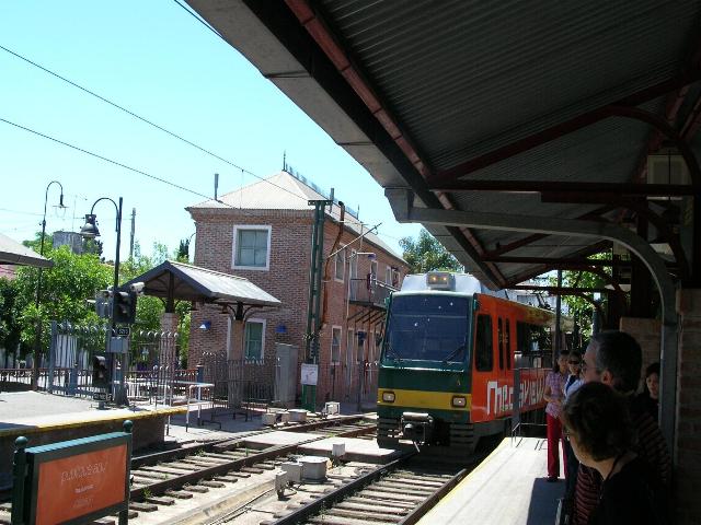 then a trip via boat up
 where the larger buildings are.
 shopping area (this is where I got my favorite belt from), When we
finished shopping we jumped back
shopping area (this is where I got my favorite belt from), When we
finished shopping we jumped back
 on
the train for the ride to Tigre and then we hopped on a boat on the
Parana River. If you like nature, this is where it’s at its best.
on
the train for the ride to Tigre and then we hopped on a boat on the
Parana River. If you like nature, this is where it’s at its best.
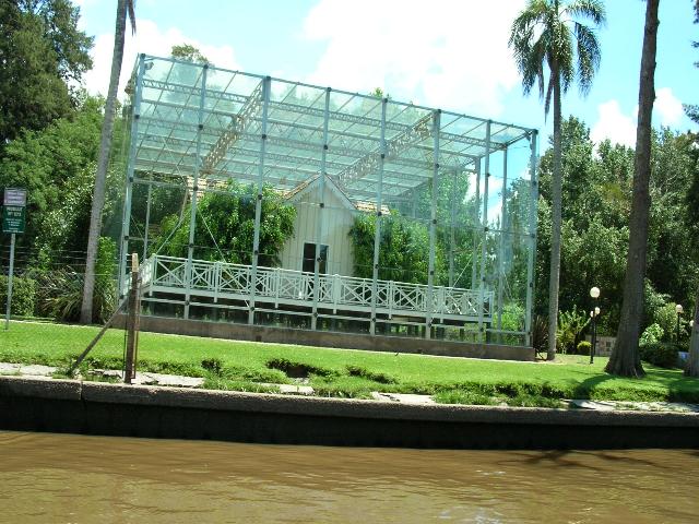
 little
island is the densely forested area. On another note, the island
was used as a prison camp (hosting
little
island is the densely forested area. On another note, the island
was used as a prison camp (hosting four ex-presidents, One of their
houses is above, encased in glass) and a strategic observation point to
guard against smugglers and protect the approaches to rivers in the
area.
four ex-presidents, One of their
houses is above, encased in glass) and a strategic observation point to
guard against smugglers and protect the approaches to rivers in the
area. 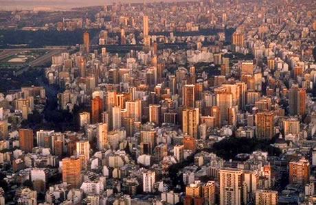
 insulated and, as always, we are very aware of our immediate surroundings.
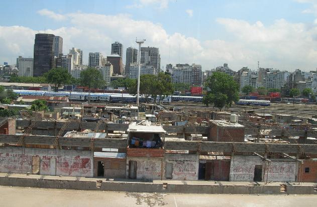 but now...No way.
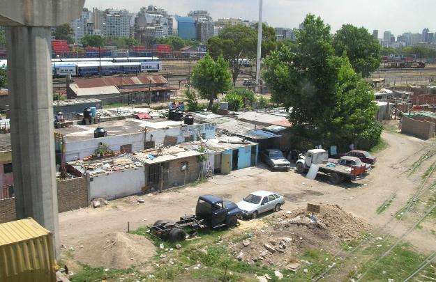 The
following photos are of some of the slums we saw and they are as bad as
anything we've seen anywhere in South America. Fact is, the walls built
around these "compounds" are very reminiscent of what we've seen in
Asia.
The
following photos are of some of the slums we saw and they are as bad as
anything we've seen anywhere in South America. Fact is, the walls built
around these "compounds" are very reminiscent of what we've seen in
Asia. 
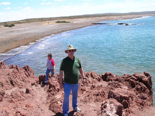
Puerto Madryn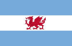
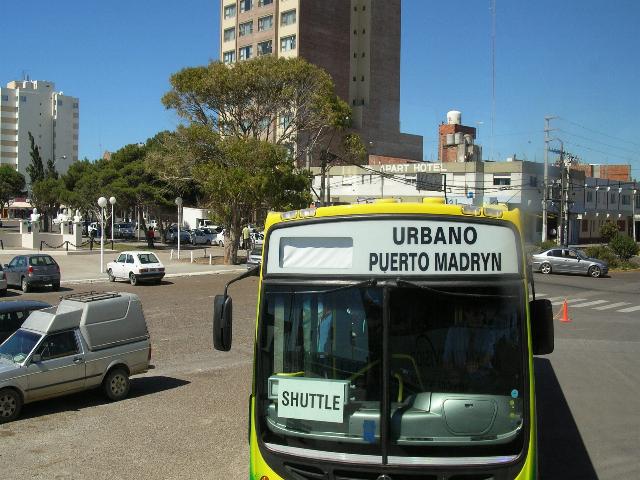 Our stop in Puerto Madryn was
interesting but the trip down the coast to where the
penguin rookeries were was BORING! There is
nothing but desert! But lets first
deal with the port city of Puerto Madryn.
Our stop in Puerto Madryn was
interesting but the trip down the coast to where the
penguin rookeries were was BORING! There is
nothing but desert! But lets first
deal with the port city of Puerto Madryn.
Puerto Madryn is the gateway to the Península Valdés, a wildlife sanctuary for birds and marine species, including rheas, oystercatchers, flamingos, egrets, whales, sea elephants, sea lions, Magellan penguins, cormorants, petrels and many other species of wildlife.
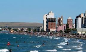 In addition, Puerto
Madryn has an interesting
history. Long
after Spanish
In addition, Puerto
Madryn has an interesting
history. Long
after Spanish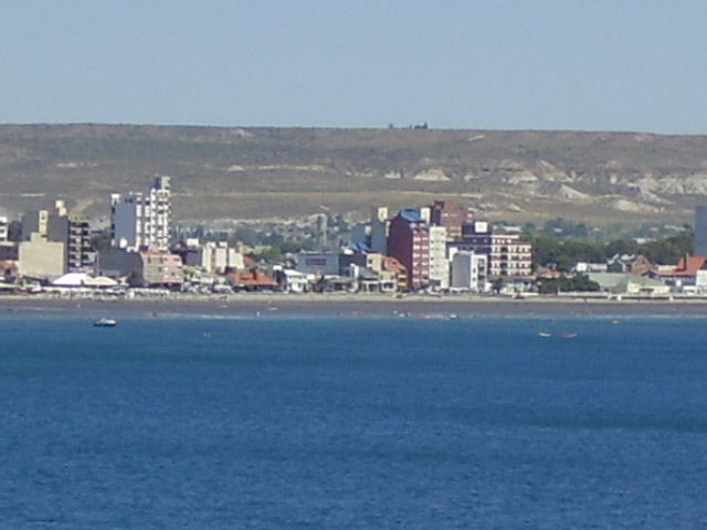 explorers landed, this area was also
settled by Welsh colonists who left Great Britain
seeking autonomy for their culture and language. The
original settlers came ashore in July 1865 and named
their first settlement Port Madryn in honor of Baron
Madryn of Wales. Over time, the colonists spread and
founded other towns, maintaining their language, customs
and architectural styles.
explorers landed, this area was also
settled by Welsh colonists who left Great Britain
seeking autonomy for their culture and language. The
original settlers came ashore in July 1865 and named
their first settlement Port Madryn in honor of Baron
Madryn of Wales. Over time, the colonists spread and
founded other towns, maintaining their language, customs
and architectural styles.
 While other cities
in the province retain much of their Welsh heritage, in
Puerto Madryn, only the street names remain.
While other cities
in the province retain much of their Welsh heritage, in
Puerto Madryn, only the street names remain.
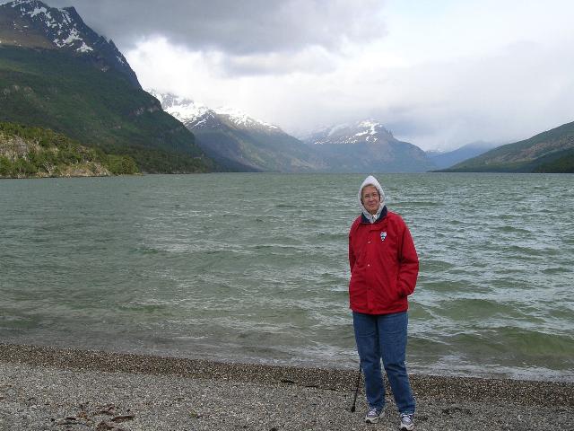
Península Valdés
Another
characteristic of the region is the contrast
between the green of the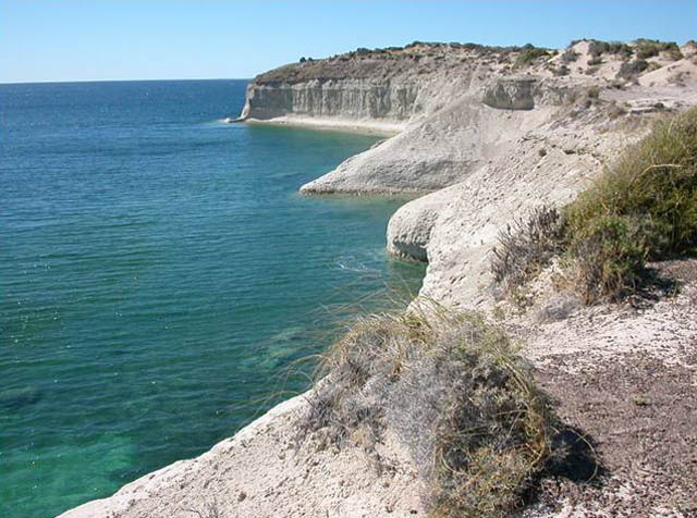 Patagonia plateau, with its tones of brownish
green and gray, and the green-blue of the sea
seen at the base of the giant cliffs that show
the last of the steps of the valley. From there
on, beaches of soft sand and gravel slopes get
gently into the sea.
Patagonia plateau, with its tones of brownish
green and gray, and the green-blue of the sea
seen at the base of the giant cliffs that show
the last of the steps of the valley. From there
on, beaches of soft sand and gravel slopes get
gently into the sea.
 In
the summer months it's very hot during the day,
temperatures rising up to 40 centigrade, but it
always gets cool at night, so do not forget to
bring a jacket, sweatshirt or sweater for these
circumstances. Also remember that the closer we
get to the
In
the summer months it's very hot during the day,
temperatures rising up to 40 centigrade, but it
always gets cool at night, so do not forget to
bring a jacket, sweatshirt or sweater for these
circumstances. Also remember that the closer we
get to the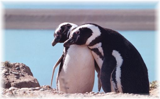 polar circle of Antarctica, the less protected
we are by the ozone layer, therefore the harming
effects of the sun can be sensed clearly. So
it's always better to bring with you, along with
your swimsuit, your sunglasses and solar
protection.
polar circle of Antarctica, the less protected
we are by the ozone layer, therefore the harming
effects of the sun can be sensed clearly. So
it's always better to bring with you, along with
your swimsuit, your sunglasses and solar
protection.
 In
winter, temperatures are low, though there's no
snow since we are by the ocean
In
winter, temperatures are low, though there's no
snow since we are by the ocean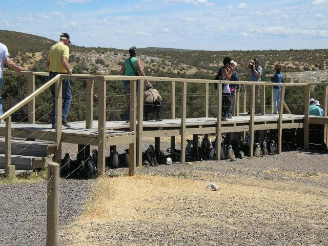 (the great climate controller). There is much
wind, so you have to bring not only warm clothes
according to the season but also a good jacket,
appropriate shoes and a cap. We were fortunate
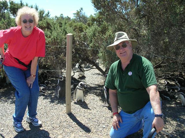
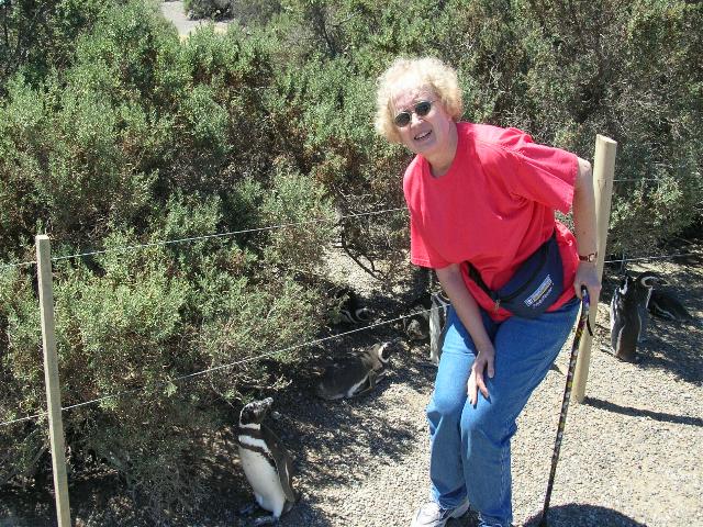
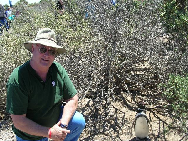
enough to visit Península Valdés,
and the penguin rookeries. It was great to
walk among all these birds and see how they nest
(they burrow into the dirt then line their nest
with feathers, ect. They give birth to
either one chick or two and survival depends
much on the weather conditions and sea
conditions.
(the great climate controller). There is much
wind, so you have to bring not only warm clothes
according to the season but also a good jacket,
appropriate shoes and a cap. We were fortunate
enough to visit Península Valdés,
and the penguin rookeries. It was great to
walk among all these birds and see how they nest
(they burrow into the dirt then line their nest
with feathers, ect. They give birth to
either one chick or two and survival depends
much on the weather conditions and sea
conditions.

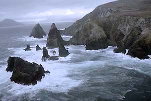
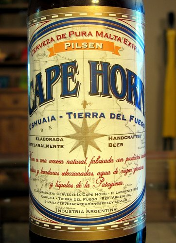
Cape Horn
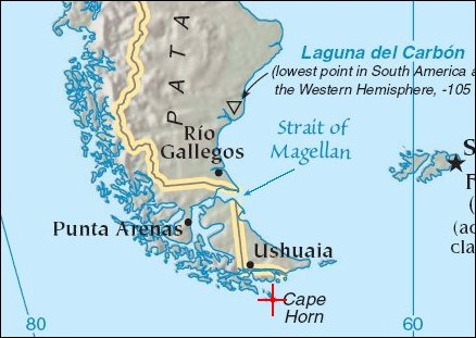
The first time I ever saw Cape Horn was from the back of a C-130 aircraft with the ramp and door open with me peering down at 100 foot waves. That’s right, 100 FOOT WAVES. They looked like they were going to wash into the aircraft. I guess I should explain what I was doing there, tied down, looking at such a fearsome sight in such perilous conditions. I was in the U.S. Air Force at the time and we were enroute to McMurdo Station, Antarctica. A ship was in distress off the coast of Cape Horn and we were asked to assist in the search and rescue operation. The waves were reported by the Argentine Navy at 100 feet in height and wind speeds of 100 miles per hour. We dropped down to 1000 feet, then to 500 feet and circled for about an hour but saw nothing save a U.S. Navy Destroyer bobbing around like a cork. Now you saw it, now you don’t. It was AWSOME!!!
Years later, this
trip became available and I seized upon it.
Vowing to ride out whatever weather the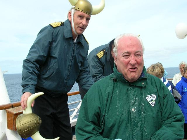
 fearsome
Cape Horn could offer, even if they had to chain
me to the deck! When we arrived at the Horn,
the water was as flat as your kitchen table and
the weather was partly cloudy and the wind at 15
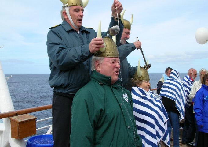
knots. We didn’t sail around Cape Horn once…We
did it three times and I got some great photos.
I even went through the "rounding the Horn"
ceremony...
fearsome
Cape Horn could offer, even if they had to chain
me to the deck! When we arrived at the Horn,
the water was as flat as your kitchen table and
the weather was partly cloudy and the wind at 15
knots. We didn’t sail around Cape Horn once…We
did it three times and I got some great photos.
I even went through the "rounding the Horn"
ceremony...
That was the COLDEST water I have EVER had poured over my head!!!
Here is a little history about Cape Horn.
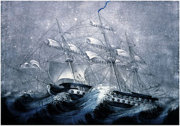
 The Cape Horn
route around South America is one of the most
dangerous nautical
The Cape Horn
route around South America is one of the most
dangerous nautical passages in the world. Both
sailors and passengers fear it because of the
many sailing mishaps that have occurred there.
passages in the world. Both
sailors and passengers fear it because of the
many sailing mishaps that have occurred there.
Cape Horn was discovered because of commercial restrictions imposed by the Dutch East India Company early in the 17th Century. The East India Company’s charter forbade any other Dutch trading company from traveling to the East Indies using either the Straits of Magellan or the Cape of Good Hope.
 A wealthy Dutch
merchant, Isaac Le Maire, was convinced that
there was
A wealthy Dutch
merchant, Isaac Le Maire, was convinced that
there was another route around South America
located south of the Straits of Magellan. The
land south of the Straits of Magellan was Tierra
Del Fuego. Most sailors at that time believed
that that Tierra Del Fuego was another continent
but Le Maire was convinced that it was just a
large island and could therefore be rounded to
the south. Also Sir Francis Drake, years
earlier, reported sailing in open ocean far
south of the Straits of Magellan. If an
alternate route to the Straits of Magellan could
be found then Le Maire could legally travel to
the
another route around South America
located south of the Straits of Magellan. The
land south of the Straits of Magellan was Tierra
Del Fuego. Most sailors at that time believed
that that Tierra Del Fuego was another continent
but Le Maire was convinced that it was just a
large island and could therefore be rounded to
the south. Also Sir Francis Drake, years
earlier, reported sailing in open ocean far
south of the Straits of Magellan. If an
alternate route to the Straits of Magellan could
be found then Le Maire could legally travel to
the
 East Indies to establish trade without
violating the East India Company charter.
East Indies to establish trade without
violating the East India Company charter.
Le Maire
therefore obtained the services of an
experienced navigator,
 Willem Schouten. He also
formed a trading company known as the Goldseekers consisting of city leaders of the
Dutch town of Hoorn. Money was raised for two
ships, the Eendracht and the Hoorn, to find the
new route.
Willem Schouten. He also
formed a trading company known as the Goldseekers consisting of city leaders of the
Dutch town of Hoorn. Money was raised for two
ships, the Eendracht and the Hoorn, to find the
new route.
In May 1615, the two ships began their expedition, sailing from England. Unfortunately, while the ships were outfitting in Patagonia, the Hoorn accidentally caught fire and was completely burned. The Eendracht continued on alone and in January 1616 it passed through a route south of the Straits of Magellan. This new route is now called Strait Of Le Maire. As the Eendracht passed through this strait, a high point on an island to the south was noted and named Cape Hoorn in honor of the town that raised funds for the expedition as well as for their recently lost ship. The English later changed this name to Cape Horn.
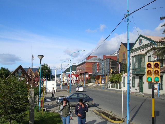
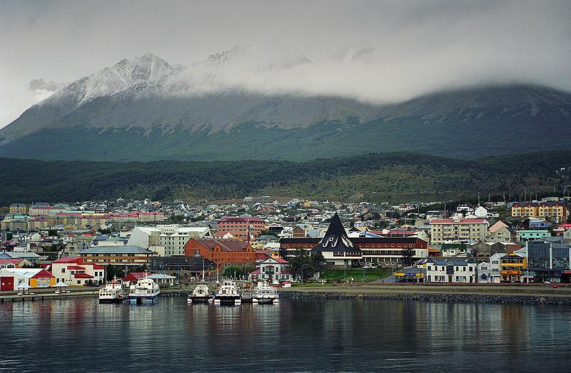
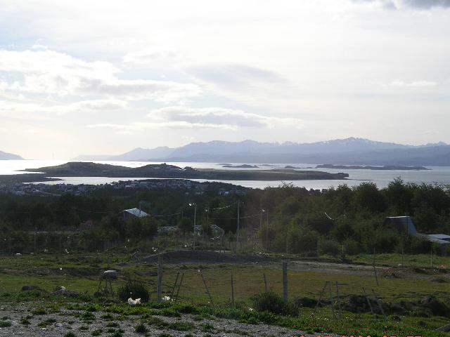
 Ushuaia
- The southernmost
city in
the world
Ushuaia
- The southernmost
city in
the world
 While there are settlements farther south, the only one of any
notable size is
Puerto Williams, Chile,
While there are settlements farther south, the only one of any
notable size is
Puerto Williams, Chile,
Ushuaia qualifies as a city, defined as a "center of population, commerce, and culture; a town of significant size and importance". Ushuaia has a fully functional hospital, an international airport, and primary and secondary schools, as well as institutions of higher learning. Its 64,000 residents enjoy an organized public transportation system and a functioning municipality, and its industrial sector, led by the Renacer Grundig electronics plant, is among the largest in Patagonia. Ushuaia also serves as the provincial capital of Tierra del Fuego.
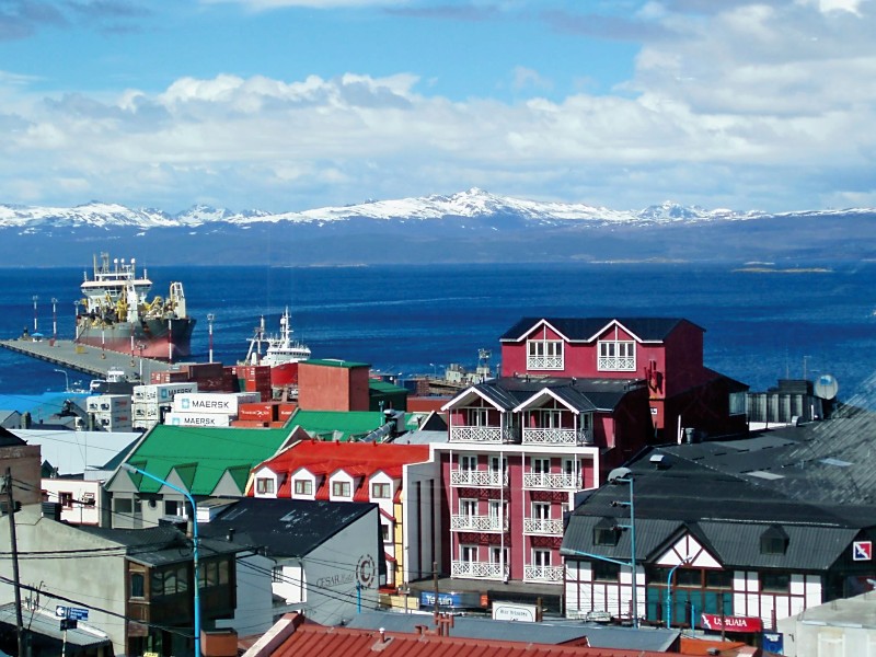
 avenue you will get to the Port of
Ushuaia and the Nautical Club. At the
end there is a catwalk that you must
take in order to get to the peninsula
where magnificent views of the city are
guaranteed. This area shelters Bahía
Encerrada, which gets frozen during
winter and becomes a Skating rink.
avenue you will get to the Port of
Ushuaia and the Nautical Club. At the
end there is a catwalk that you must
take in order to get to the peninsula
where magnificent views of the city are
guaranteed. This area shelters Bahía
Encerrada, which gets frozen during
winter and becomes a Skating rink.
Malvinas Argentinas street, boasts the historical Beban House and the reconstruction of the old town, a relic that recreates Ushuaia during the days of the pioneers.
On
the opposite extreme of the city, along
the main street (San Martin) up to its
crossing with Yaganes St. you will reach
the
 legendary
Jail of the end of the world, now
transformed into a museum (Museo del
Presidio). A must visit, where there are
even wax statues of the most famous
criminals that were sent to that place.
legendary
Jail of the end of the world, now
transformed into a museum (Museo del
Presidio). A must visit, where there are
even wax statues of the most famous
criminals that were sent to that place.
This historical prison was shut down in 1947. Nowadays most of it still stands conserving its original state, with the cells used by the convicted, their stone walls and the bars and grids.
This jail is the symbol of Ushuaia's colonization. It began to be built in 1902 and was finished in 1920. The works were carried out by the prisoners themselves, and had 380 one-person cells.
The
main reason for its existence was to
lodge re-offenders, but it ended up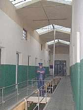 with a mixture of the most dangerous
criminals, thieves, political prisoners,
members of the armed forces, etc.
with a mixture of the most dangerous
criminals, thieves, political prisoners,
members of the armed forces, etc.
Those prisoners with good behavior were rewarded with the chance of working outside the jail, or in the workshops. This was paid work, fact that enabled some of them to save some money for the moment they were released or to send it to their relatives outside. Among the workshops there were: press, photography, shoe repair, tailor, carpentry, bakery, medical service, pharmacy and so on, all of which gave Ushuaia's inhabitants the basic supplies in order to live. Otherwise they would depend on ships arriving to the port only once a month, or even less.
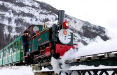 Another
of
Ushuaia's
attractions.
It's
true
name is
"Ferrocarril
Austral
Fueguino",
a.k.a.
the
Train of
the End
of the
World
which,
along
with the
jail,
constitutes
an icon
of the
island.
Another
of
Ushuaia's
attractions.
It's
true
name is
"Ferrocarril
Austral
Fueguino",
a.k.a.
the
Train of
the End
of the
World
which,
along
with the
jail,
constitutes
an icon
of the
island.
This railway's history is, as almost everything in this city, linked to the prisoners of the mythical jail.
An elegant and antique formation of heated wagons, with wide windows and pulled by a steam locomotive, took us along a 8 Km. long tour departing from the End of World Station up to the Tierra del Fuego National Park Station. The round trip total time is 1 hour 40 minutes, approximate.
Tierra del Fuego National Park
 The
Tierra
del
Fuego
National
Park is
the
farthest
south
protected
The
Tierra
del
Fuego
National
Park is
the
farthest
south
protected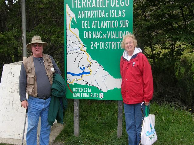 region
of
Argentina
and the
only
national
park
that
possesses
maritime
coasts,
embracing
a strip
of land
6 km
(3.75
mi) wide
over the
Beagle
Channel.
It was
founded
in 1960
and has
a
surface
area of
63,000
hectares
(151,200
acres).
region
of
Argentina
and the
only
national
park
that
possesses
maritime
coasts,
embracing
a strip
of land
6 km
(3.75
mi) wide
over the
Beagle
Channel.
It was
founded
in 1960
and has
a
surface
area of
63,000
hectares
(151,200
acres).
As a
member
of the
circuit
of
protected
areas of
the
Andean
Patagonia,
the idea
was to
continue
protecting
the land
that
belonged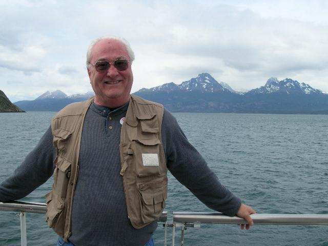
 to the
sub
Antarctic
forest.
The park
offers
protection
to
representatives
of 6
species
of
arboreal
animals
that have
established
themselves
on the
island
and now
pertain
to these
forests.
It also
shelters
native
fauna of
the
region
and
preserves
ruins
from a
town of
ancient yámana
aborigines.
You can
find
yourself
in the
Lapataia
Bay
among
the
remains
of
mussel
shells
and
animal
bones,
which is
evidence
that the
mussels
constituted
the
animals'
diet.
You may
even
find
some
utensils
or
tools,
all of
which
add to
the
interest
of the
area.
to the
sub
Antarctic
forest.
The park
offers
protection
to
representatives
of 6
species
of
arboreal
animals
that have
established
themselves
on the
island
and now
pertain
to these
forests.
It also
shelters
native
fauna of
the
region
and
preserves
ruins
from a
town of
ancient yámana
aborigines.
You can
find
yourself
in the
Lapataia
Bay
among
the
remains
of
mussel
shells
and
animal
bones,
which is
evidence
that the
mussels
constituted
the
animals'
diet.
You may
even
find
some
utensils
or
tools,
all of
which
add to
the
interest
of the
area.
 Four
small
mountain
chains,
that run
from
northwest
to
southeast,
Four
small
mountain
chains,
that run
from
northwest
to
southeast,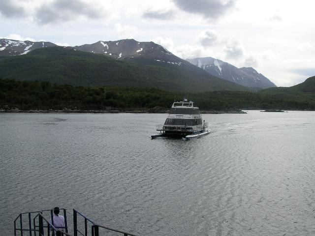 enclose
deep,
practically
isolated
valleys.
On the
maritime
coast of
the
Beagle
Channel
-an
irregular
stretch
of 6 km
(3.75
mi) of
woods-,
you can
distinguish
the deep
bay of Lapataia
and
countless
other
small
bays and
coves,
whose
beaches
and
banks
serve as
the
ideal
environment
for the
existence
of
maritime
fauna.
enclose
deep,
practically
isolated
valleys.
On the
maritime
coast of
the
Beagle
Channel
-an
irregular
stretch
of 6 km
(3.75
mi) of
woods-,
you can
distinguish
the deep
bay of Lapataia
and
countless
other
small
bays and
coves,
whose
beaches
and
banks
serve as
the
ideal
environment
for the
existence
of
maritime
fauna.
 Parts of
the two
main
lakes,
the
Fagnano
and the
Roca,
and
other
minor
ones,
sprinkle
into the
park
area,
which
also
embraces
a
stretch
of the
Olivia,
Pipa,
and Roca
rivers.
These
rivers
flow
into the
waters
of Lake
Roca in
the
Lapataia
Bay.
Parts of
the two
main
lakes,
the
Fagnano
and the
Roca,
and
other
minor
ones,
sprinkle
into the
park
area,
which
also
embraces
a
stretch
of the
Olivia,
Pipa,
and Roca
rivers.
These
rivers
flow
into the
waters
of Lake
Roca in
the
Lapataia
Bay.
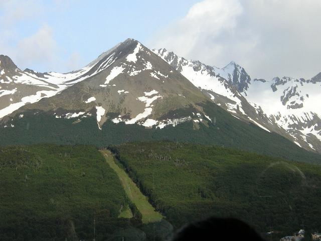
The Park possesses six excursion trails: Pampa Alta Trail, Costera Trail, and Las Lengas Trail, paths that allow you to reach the bay areas of the park and the hills, from which you can see the beautiful view of the Beagle Channel and the mountain chain of Tierra del Fuego.
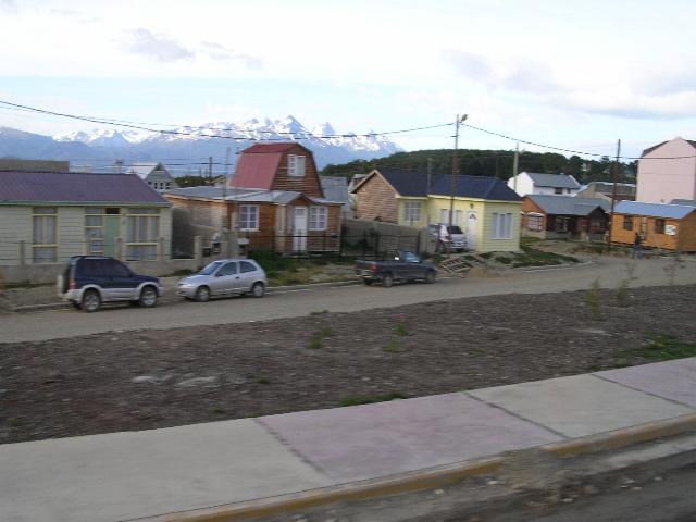
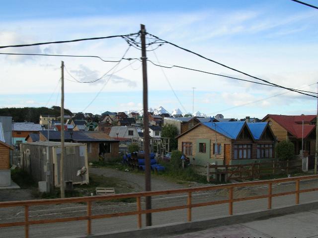
Typical Upscale Housing Typical Worker Housing Typical Worker Neighborhood
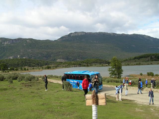
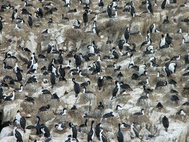
This is our Tour Bus These are Black & White Cormorants View of the Beagle Channel
Climate of Argentina
The hottest and coldest temperature extremes recorded in South America have occurred in Argentina. A record high temperature of 49.1 °C (120.4 °F), was recorded at Villa María, Córdoba, on 2 January 1920. The lowest temperature recorded was −39 °C (−38.2 °F) at Valle de los Patos Superior, San Juan, on 17 July 1972.
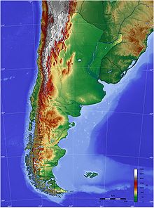
The total surface area (excluding the Antarctic claim) is 2,766,891.2 km2 (1,068,302.7 sq mi), of which 30,200 km2 (11,700 sq mi) (1.1%) is water. Argentina is about 3,900 km (2,400 mi) long from north to south, and 1,400 km (870 mi) from east to west (maximum values). There are four major regions: the fertile central plains of the Pampas, source of Argentina's agricultural wealth; the flat to rolling, oil-rich southern plateau of Patagonia including Tierra del Fuego; the subtropical northern flats of the Gran Chaco, and the rugged Andes mountain range along the western border with Chile.
The highest point above sea level is in Mendoza province at Cerro Aconcagua (6,962 m (22,841 ft)), also the highest point in the Southern and Western Hemisphere. The lowest point is Laguna del Carbón in Santa Cruz province, -105 m (−344 ft) below sea level. This is also the lowest point in South America. The geographic center of the country is in south-central La Pampa province. The easternmost continental point is northeast of Bernardo de Irigoyen, Misiones, (Argentina's easternmost continental point)) the westernmost in the Mariano Moreno Range in Santa Cruz province (Argentina's westernmost point). The northernmost point is at the confluence of the Grande de San Juan and Mojinete rivers in Jujuy province, (Argentina's northernmost point)) and the southernmost is Cape San Pío in Tierra del Fuego. (Argentina's southernmost point)
The major rivers are the Paraná (the largest), the Pilcomayo, Paraguay, Bermejo, Colorado, Río Negro, Salado and the Uruguay. The Paraná and the Uruguay join to form the Río de la Plata estuary, before reaching the Atlantic. Regionally important rivers are the Atuel and Mendoza in the homonymous province, the Chubut in Patagonia, the Río Grande in Jujuy and the San Francisco River in Salta.
Money:
Formerly stable prices and exchange rates were disrupted, however: the peso lost about 70% of its value from early 1948 to early 1950, and inflation reached 50% in 1951. Foreign policy became more isolationist, straining U.S.-Argentine relations. Perón intensified censorship as well as repression: 110 publications were shuttered, and numerous opposition figures were imprisoned and tortured. Advancing a personality cult, Perón rid himself of many important and capable advisers, while promoting patronage. A violent coup, which bombarded the Casa Rosada and its surroundings killing many, deposed him in 1955. He fled into exile, eventually residing in Spain.
Now the peso is stable again and inflation is under control.