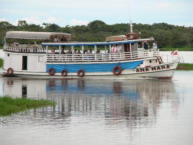
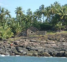
 Another
stop was at
Santarém, a city in the state of
Pará in
Brazil. We
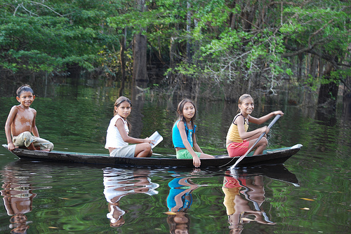
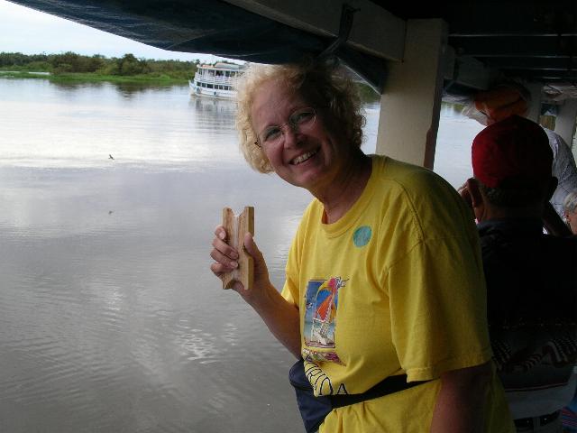
boarded a tour boat (left) for a tour of the tributaries that form the
Amazon. Logging is the mainstay of
Another
stop was at
Santarém, a city in the state of
Pará in
Brazil. We
boarded a tour boat (left) for a tour of the tributaries that form the
Amazon. Logging is the mainstay of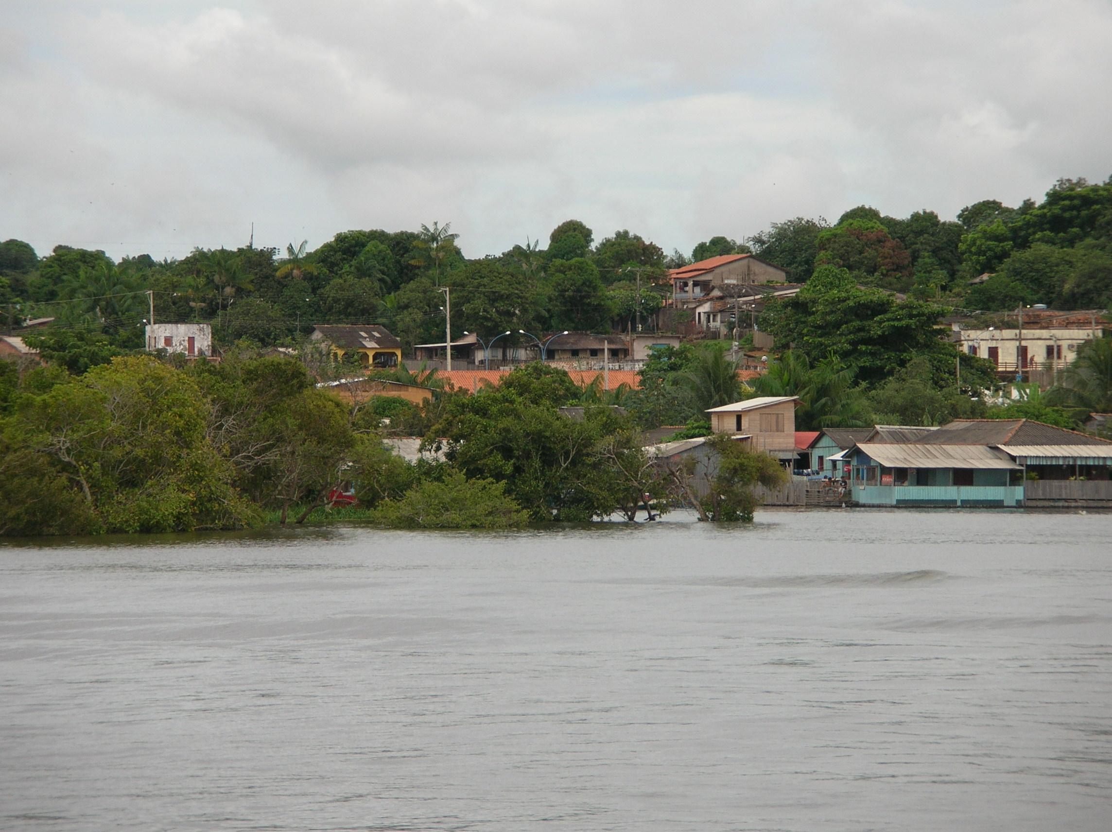 Santarém
and the
Tapajós joins the
Amazon River
at Santarém,
which makes it a popular location for
tourism. It was
once home to the
Tapajós Indians,
a tribe of
Native Americans
after which the river was named, and the leaders of a large,
agricultural chiefdom that flourished before the arrival of Europeans.
Santarém
and the
Tapajós joins the
Amazon River
at Santarém,
which makes it a popular location for
tourism. It was
once home to the
Tapajós Indians,
a tribe of
Native Americans
after which the river was named, and the leaders of a large,
agricultural chiefdom that flourished before the arrival of Europeans.
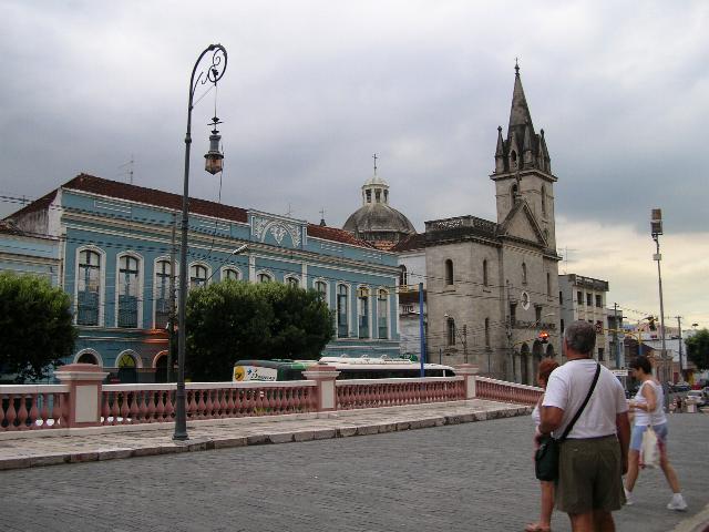
As a point of interest,
Santarém is also
the name of the original city in
Portugal, that
gave the name Santarém to this Brazilian city.
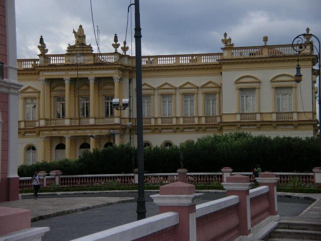
The city is the
home to the
Roman Catholic Diocese of Santarém.

 Its
Santarém-Maestro Wilson Fonseca Airport
is an important alternative and supporting airfield in the Amazon
region. It has regular connections to cities in Brazil.
Its
Santarém-Maestro Wilson Fonseca Airport
is an important alternative and supporting airfield in the Amazon
region. It has regular connections to cities in Brazil.
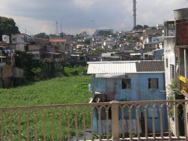
Santarém is an important regional
market center in Lower Amazonia located midway between the larger cities
of Belém and Manaus. The economy is based on logging, agriculture,
cattle and mining.
The city has seen many 'cycles' of development
dominated by one or a few economic activities, including (in the last
century) rubber tapping, coffee production and gold mining. Most
recently, there has been a huge growth in the area of soy plantations.
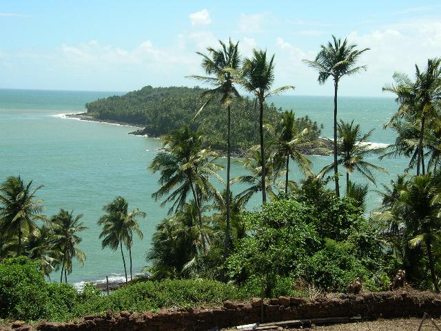
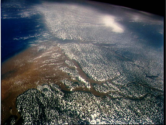
Santarém is bordered by the Amazon
and the Tapajós rivers. Both run along many kilometers in the front of
the city, side by side, without mixing. The Amazon's milky colored water
carries sediment from the Andes in the East, while the Tapajós's water
is somewhat warmer and has a deep-blue tone. This phenomenon is called
"The meeting of the waters" by the locals.
But what is a trip to the Amazon
without mentioning the bio-diversity...When you first picture the
Amazon... What image first springs to mind? Chances are it's one of the
animals unique to the Amazon. People think of parrots, or monkeys or
maybe snakes.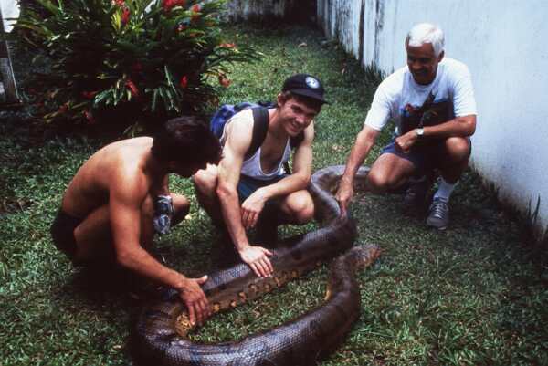 Some think of piranhas, or poison dart frogs.
In any case, our photos can never
encompasses even a tiny fraction of the animal life. Scientists estimate
half of the world's animal species live in rainforests. This is the
world's treasury of biodiversity. In these pages you'll get some feeling
for the wonder and diversity of Amazon animals.
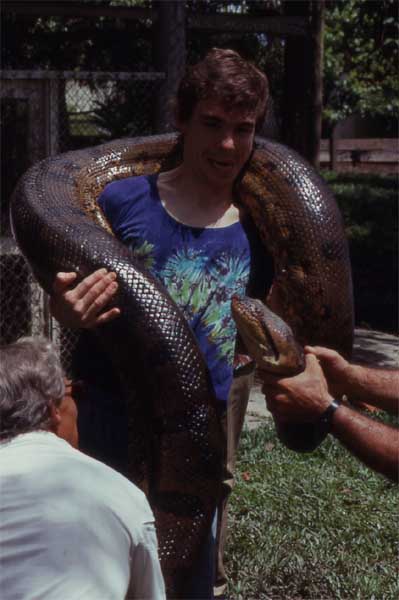
How about starting with a
Anaconda...
Or a parrot (they are everywhere) or a moth with a 6 inch
wing span (one of these landed on Lois's leg on Deck 14 of the cruise ship as we
traversed the Amazon river.
(one of these landed on Lois's leg on Deck 14 of the cruise ship as we
traversed the Amazon river.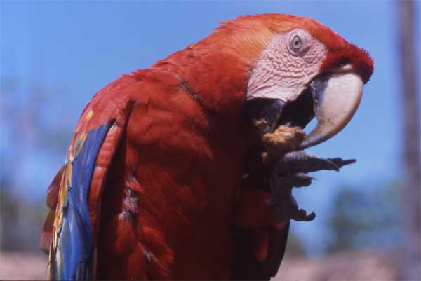
Or maybe a giant apple
snail (they inhabit the tributaries feeding the Amazon river are are
truly huge creatures (imagine these in your garden).
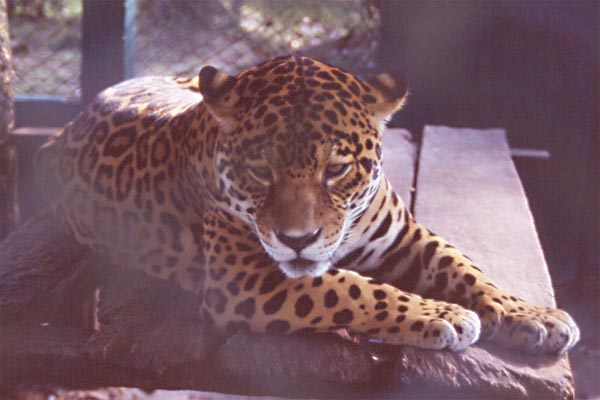
Maybe a Jaguar is your idea of a
Amazonian creature. We saw Brazilian soldiers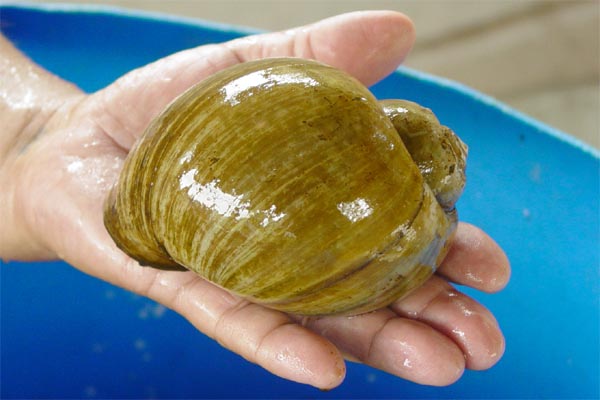 with jaguars on leashes, taking them for a walk like the family dog...
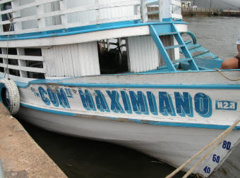
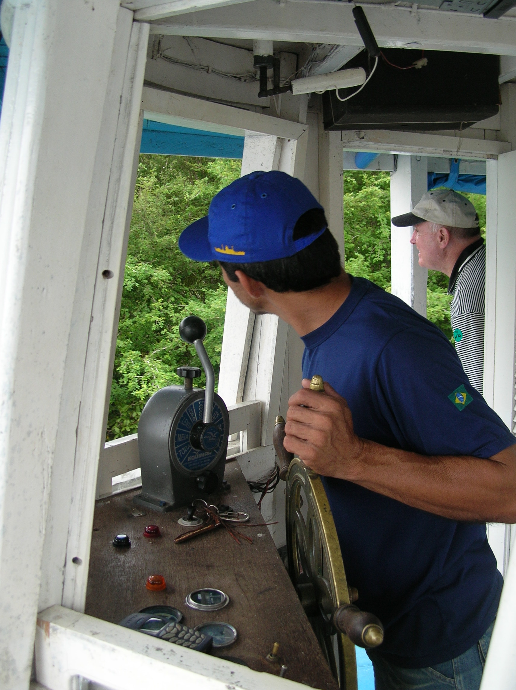
Not me! When we took tours up and down the various tributaries of
the Amazon, the captain of the little boats we were
with jaguars on leashes, taking them for a walk like the family dog...
Not me! When we took tours up and down the various tributaries of
the Amazon, the captain of the little boats we were
 riding
in would pull the boat up to the nearest bush (it was the rainy season)
and the crew would (blindly) sweep the branches aside, dislodging all
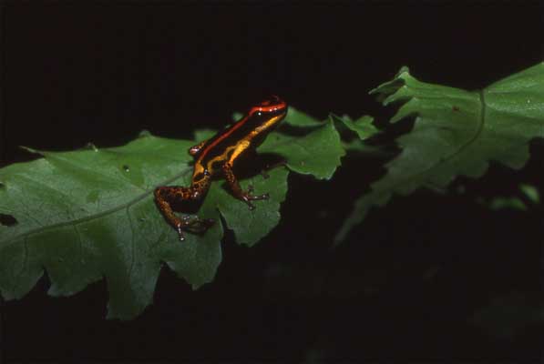
manner of inset life and poison frogs from their respective perches.
riding
in would pull the boat up to the nearest bush (it was the rainy season)
and the crew would (blindly) sweep the branches aside, dislodging all
manner of inset life and poison frogs from their respective perches.
We were absolutely amazed at how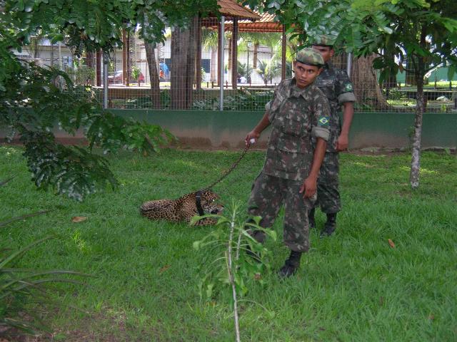 cavalier the crew was towards the unknown quantity of the bushes given
the abundance of poisonous snakes, spiders, or whatever...
cavalier the crew was towards the unknown quantity of the bushes given
the abundance of poisonous snakes, spiders, or whatever...
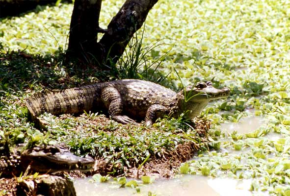
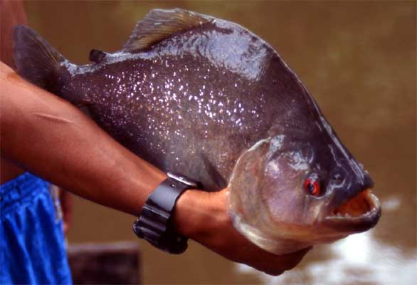
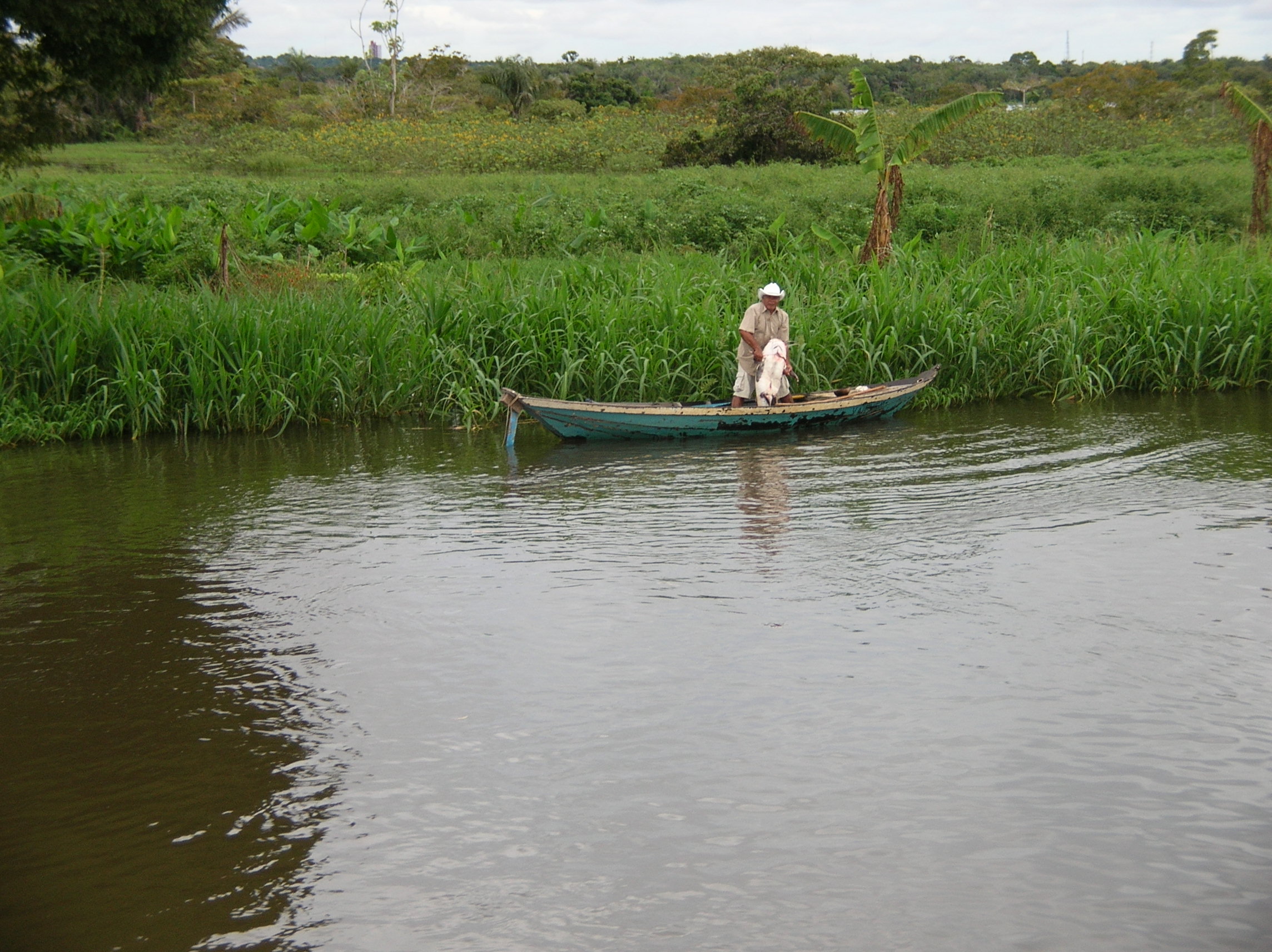
I di dn't
mention the Caymans
or said much about the Piranhas that proliferate the Amazon except that
we went fishing for them (see Lois's photo at the top of this page for
how the captain had us use rolled-up fishing line and bait to catch
these rascals. If we had been successful the captain's wife would
cook them for us (the family lives in the bottom of these river boats)
We weren't successful in our fishing adventure but I did get a photo
from those who were...
dn't
mention the Caymans
or said much about the Piranhas that proliferate the Amazon except that
we went fishing for them (see Lois's photo at the top of this page for
how the captain had us use rolled-up fishing line and bait to catch
these rascals. If we had been successful the captain's wife would
cook them for us (the family lives in the bottom of these river boats)
We weren't successful in our fishing adventure but I did get a photo
from those who were...
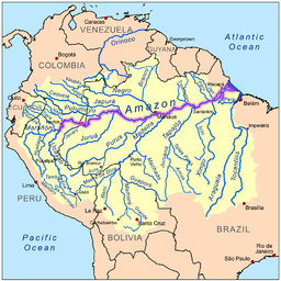
After traveling almost
a thousand miles up the Amazon, we came upon the place where the Rio
Negro and the Amazon meet and blend together.
The Rio Negro
or "Black River" is the largest left tributary of the
Amazon and the
largest
blackwater river
in the world. It has its sources along the watershed between the
Orinoco
%20and%20the%20Rio%20Solimões%20near%20Manaus.jpg) and
the Amazon basins, and also connects with the Orinoco by way of the
Casiquiare canal.
In Colombia, where the sources are located, it is called the Guainía
River.
and
the Amazon basins, and also connects with the Orinoco by way of the
Casiquiare canal.
In Colombia, where the sources are located, it is called the Guainía
River.
Its main affluent is the
Vaupés, which
disputes with the headwaters of the
Guaviare branch
of the
Orinoco, the
drainage of the eastern slope of the
Andes of
Colombia. The Rio
Negro flows into the Rio Solimões to form the Amazon River below
Manaus,
Brazil.
While the name Rio
Negro means Black River, its waters aren't exactly black;
they are similar in color to strong
tea. The dark
color comes from
humic acid
from incomplete breakdown of phenol-containing vegetation from sandy
clearings. The river's name arises from the fact that it looks black
from afar.
Rio Negro is navigable for 700 km
above its mouth for 1 meter of water in the dry season, but it has many
sandbanks and minor difficulties. It forms part of the international
boundary between Colombia and Venezuela.
In the
wet season, it
floods the country far and wide, sometimes to a breadth of 30 km, for
long distances, and for 650 km up. During this time, from April until
October, it is a succession of lagoons, full of long islands and
intricate channels as far as
Santa Isabel do Rio Negro.
The foothills of the Andes begin just before reaching the
Vaupés River. At
this point, the Negro narrows and is filled with many large rocks over
which it violently flows in cataracts, rapids and whirlpools. Despite
the impediments, canoes and motor launches ascend past
São Gabriel da Cachoeira
to the
Andes.
Another 150 miles up the Rio Negro
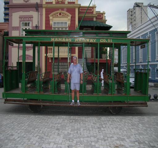
brought us to a city in the middle of the Amazon named Manaus.
It's an amazing place. After a thousand miles plus of river and
jungle spring this city of two
 and
one half million
inhabitants and some huge industrial complexes. Manaus even boasts a
world class opera house. Manaus has no roads in or out of the city
but sports a enormous airport complex that does a huge airfreight
business and of course, the Rio Negro and the Amazon is used to freight
products manufactured in Manaus.
and
one half million
inhabitants and some huge industrial complexes. Manaus even boasts a
world class opera house. Manaus has no roads in or out of the city
but sports a enormous airport complex that does a huge airfreight
business and of course, the Rio Negro and the Amazon is used to freight
products manufactured in Manaus.
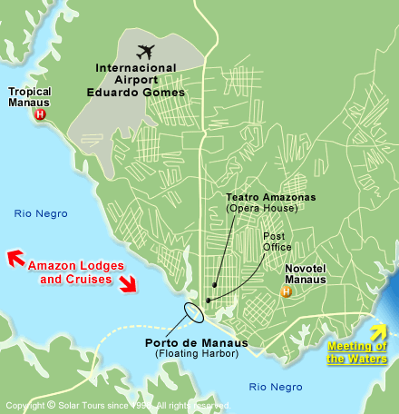
Manaus, capital of Amazonas, is
located in the middle of the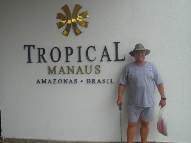 Amazon forest;
A few air companies link USA to Manaus;
European visitors may find easier to come to Manaus via a city in
Brazilian northeast, like
Fortaleza,
instead of going to Rio or São Paulo.
Amazon forest;
A few air companies link USA to Manaus;
European visitors may find easier to come to Manaus via a city in
Brazilian northeast, like
Fortaleza,
instead of going to Rio or São Paulo.
In the early years of the
twentieth century the city of Manaus, capital of Amazonas, became very
wealthy and the most important cultural centre in the Northern Region of
Brazil.
The old rubber barons dreamed
of transforming it into a European style city and called it "the Paris
of the Tropics"; the
movie Fitzcarraldo,
by German director Werner Herzog, was shot in the Amazon and gives an
idea of what life was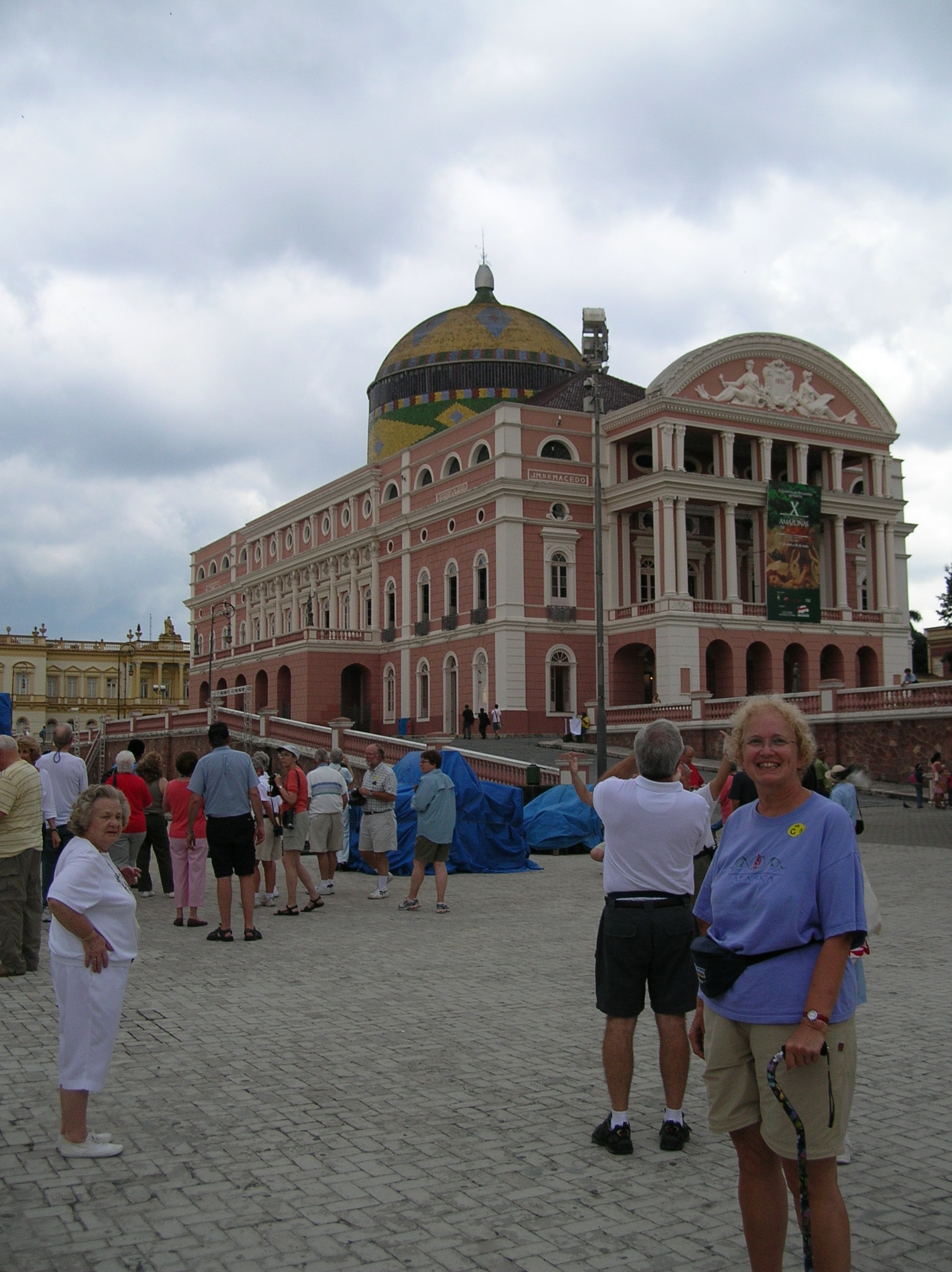 like during the rubber cycle.
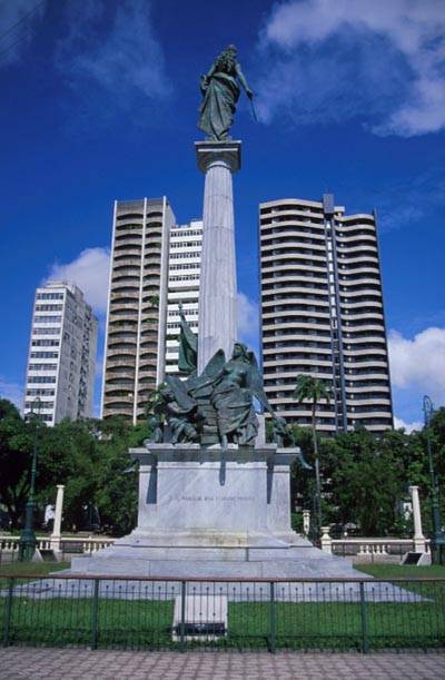
A reflection of this period of opulence
is to be found in the mansions and monuments of Manaus, such as the
Amazonas Opera House
(photo Right), opened in 1896. Built with the aid of materials and
artists brought from Europe, its central area, in the shape of a harp,
can seat 640 people in the stalls.
like during the rubber cycle.
A reflection of this period of opulence
is to be found in the mansions and monuments of Manaus, such as the
Amazonas Opera House
(photo Right), opened in 1896. Built with the aid of materials and
artists brought from Europe, its central area, in the shape of a harp,
can seat 640 people in the stalls.
In 1965 it was declared part of the
Brazilian National Heritage
and was reopened in 1996 after complete overhauling. Manaus also retains
replicas of several British constructions, such as the floating dock for
the port and the surrounding buildings. The Palace of Justice has traces
of the French architectural style, and many buildings, such as the
Municipal Market, were influenced by the art nouveau style. Another
example of period architecture is the Palácio Rio Negro, former seat of
the
State Government.
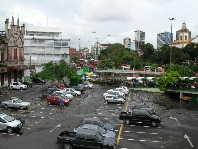 Our
first view of Manaus wasn't so flattering see photo above left) nor was
our first view of the riverfront
Our
first view of Manaus wasn't so flattering see photo above left) nor was
our first view of the riverfront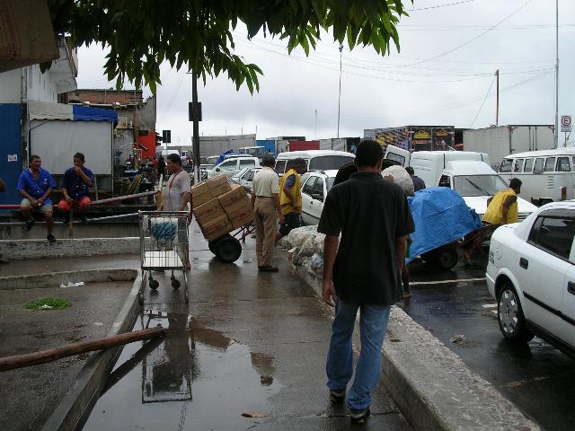 (Right)
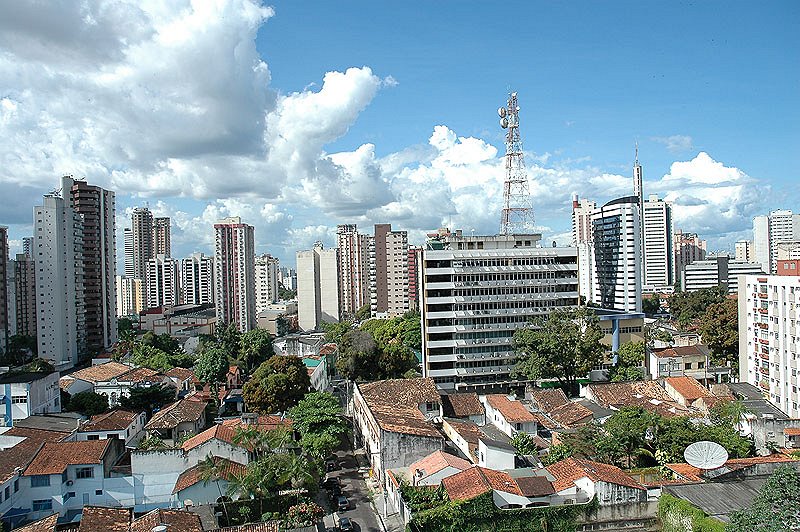
With the end of the rubber boom, Manaus went into decline and only
entered a period of renewed development in the 1950s. A turning point
was reached in 1967, when the
Manaus Free Zone
was established by the federal government. From that date on, the
capital of Amazonas has passed through great changes, becoming an
(Right)
With the end of the rubber boom, Manaus went into decline and only
entered a period of renewed development in the 1950s. A turning point
was reached in 1967, when the
Manaus Free Zone
was established by the federal government. From that date on, the
capital of Amazonas has passed through great changes, becoming an
of electrical and
electronic goods (nowadays, Manaus is the supplier for the entire
country of, e.g., DVD players and computer monitors).

As you can certainly
determine from ALL the above photos, there is a lot to see in the Amazon. The
thousand plus mile journey from the mouth of the Amazon to Manaus was more than
enlightening it was a revelation.
We saw where the rainforest had
been decimated but in it's place were thousands of acres of sugar cane
and sugar beets most of which was
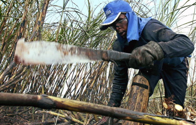 being
converted into ethanol for use in ALL of Brazil's millions of vehicles.
being
converted into ethanol for use in ALL of Brazil's millions of vehicles.
Everywhere we went in Brazil the cars, buses, truck, motor scooters,
etc. ran on ethanol. Fact is Brazil is now energy independent as
reported in all of Brazils's news papers, here is an excerpt; "With
the price of oil nearing $100 a barrel on world markets, Brazil is in
the privileged position of looking on with indifference.
When OPEC imposed an oil embargo on the West in 1973, sending the
industrialized world’s economies into a tailspin – economic stagnation
and inflation gave rise to “stagflation” – Brazil vowed never to be at
the mercy of oil producers again. It launched a national program to
create a viable alternative to gasoline, one that could use the nation’s
sugarcane industry to produce enough ethanol to meet its economic needs.
At the time, Wall Street scoffed at Brazil’s conceit. Why would any
nation need to change its lifestyle when the world adjusted to
intermittent interruptions in oil?
Brazilian officials dismissed this mockery by New York and London and
pressed on, often with spectacular setbacks, and a public resistant to the inconveniences of “flexible
fuels” – cars that run on either ethanol or gasoline, the cheaper of
which was not universally available throughout the country.
setbacks, and a public resistant to the inconveniences of “flexible
fuels” – cars that run on either ethanol or gasoline, the cheaper of
which was not universally available throughout the country.
Brazil’s determination, however, paid off last year when, to the dismay
of the industrialized world, Brazil declared its energy independence:
Its sugarcane-based ethanol industry replaced gasoline as a
cost-effective alternative fuel.
With the price of oil skyrocketing this year, Brazil has managed to pull
off what the United States vowed to do when Jimmy Carter was president
and is not any closer to accomplishing energy independence with
Obama now in his second year and still
has no clear energy policy for the United States.
Brazil’s success is remarkable: In a single generation it has ended its
dependence on imported oil."
See you on the
next trip up the Amazon...


 When you arrive, you are faced with
climbing a very steep hill with rocky, mismatched steps in ninety degree
plus heat and oppressive humidity levels. The climb is
interspersed with prisoner cells carved into the solid rock hillside
(Lois and I are standing in front of a cell, above),
When you arrive, you are faced with
climbing a very steep hill with rocky, mismatched steps in ninety degree
plus heat and oppressive humidity levels. The climb is
interspersed with prisoner cells carved into the solid rock hillside
(Lois and I are standing in front of a cell, above),
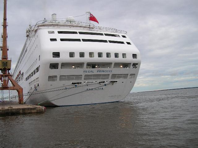
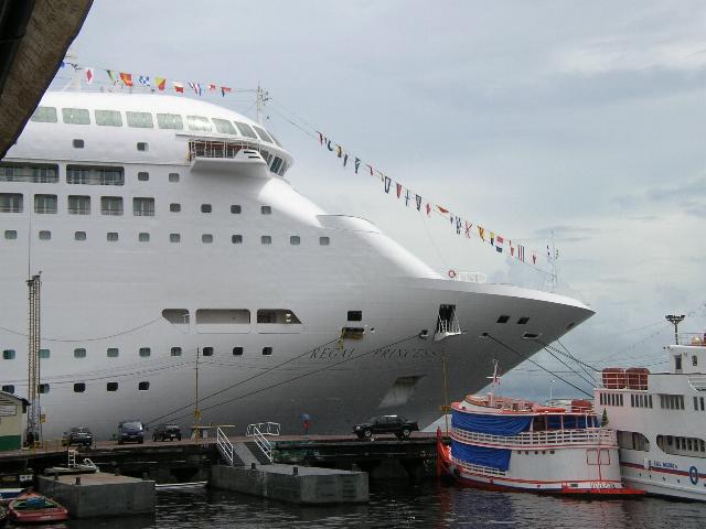
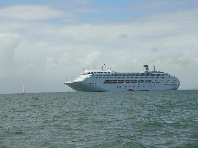 aground about 100 miles from the mouth of the Amazon on
a large, underwater sandbar. Here we were, a
hundred miles from land and the Captain and crew from
the Goodship Lollypop (Princess Regal) wasn't giving us
any information. No one knew if we were a.
sinking? b. what hit the ship? c. If the ship had to be
evacuated? d. What then? or e. JUST WHAT THE HELL
WAS GOING ON?
aground about 100 miles from the mouth of the Amazon on
a large, underwater sandbar. Here we were, a
hundred miles from land and the Captain and crew from
the Goodship Lollypop (Princess Regal) wasn't giving us
any information. No one knew if we were a.
sinking? b. what hit the ship? c. If the ship had to be
evacuated? d. What then? or e. JUST WHAT THE HELL
WAS GOING ON?
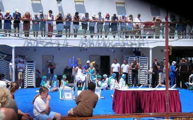
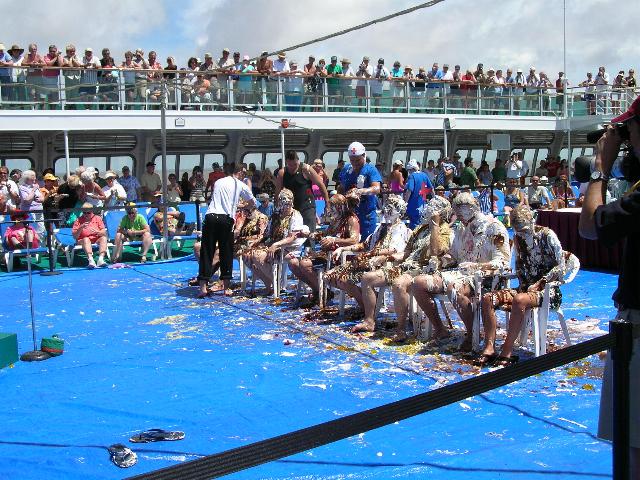 ceremony. When we crossed the "line" we had a
party. When I was in the military, we just drank
beer and celebrated that way but on a cruise ship...It's
different. You also get a pie-in-the-face (right). King
Neptune and his wife
ceremony. When we crossed the "line" we had a
party. When I was in the military, we just drank
beer and celebrated that way but on a cruise ship...It's
different. You also get a pie-in-the-face (right). King
Neptune and his wife
 than the next ten largest rivers combined. The
Amazon, which has the largest
than the next ten largest rivers combined. The
Amazon, which has the largest
 from the Atlantic ocean! The river is the Pará, part of the
greater Amazon river system, separated from the larger part of
the Amazon delta by Ilha de Marajó. Belém is built on a number
of small islands intersected by channels and other rivers. See
the
map.
from the Atlantic ocean! The river is the Pará, part of the
greater Amazon river system, separated from the larger part of
the Amazon delta by Ilha de Marajó. Belém is built on a number
of small islands intersected by channels and other rivers. See
the
map.
 nineteenth
century rubber boom, and is now a large city with millions of
inhabitants.
nineteenth
century rubber boom, and is now a large city with millions of
inhabitants.
